
Stob Coire Bhealaich - 1100m
Aonach Beag - 1234m
Aonach Mor - 1221m
Carn Mor Dearg - 1220m
Carn Dearg Meadhonach - 1179m
Ben Nevis - 1344m
Tuesday 28th June 2011
Aonach Beag - 1234m
Aonach Mor - 1221m
Carn Mor Dearg - 1220m
Carn Dearg Meadhonach - 1179m
Ben Nevis - 1344m
Tuesday 28th June 2011
 Weather/Conditions: Sunny weather with quite a lot of cloud bubbling around, but generally settled and warm in the sun.
Distance/Ascent/Time: 23.3km / 1500m / 12h 10m
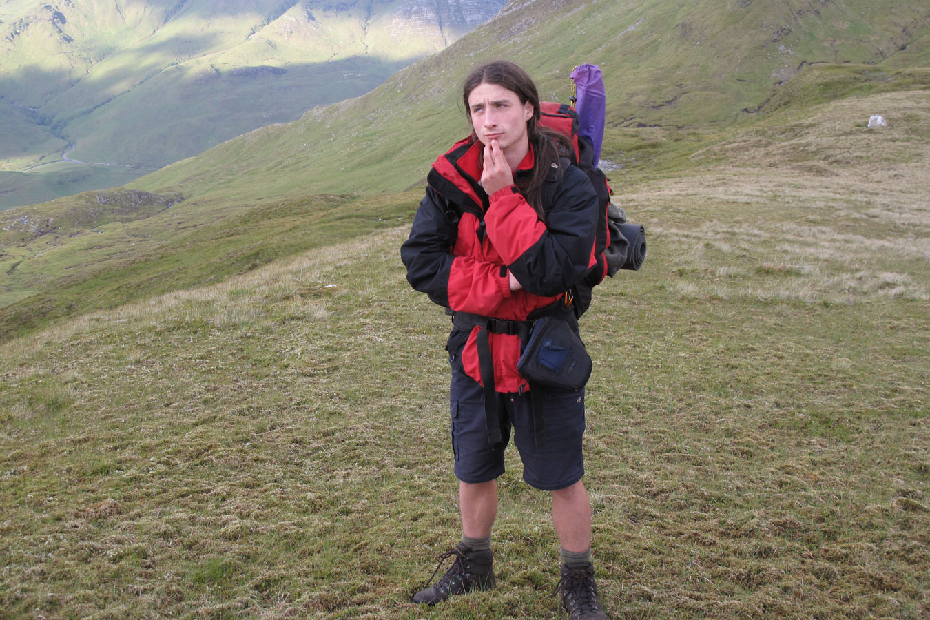
Accompanying: Dougie
I'd been texting my friend James Seaman from Fort William who'd given me train times for the day. Both were late afternoon and evening so we had all the time of the day. We didn't leave our campsite until 7am. It had been an incredible campsite for a calm summer night.

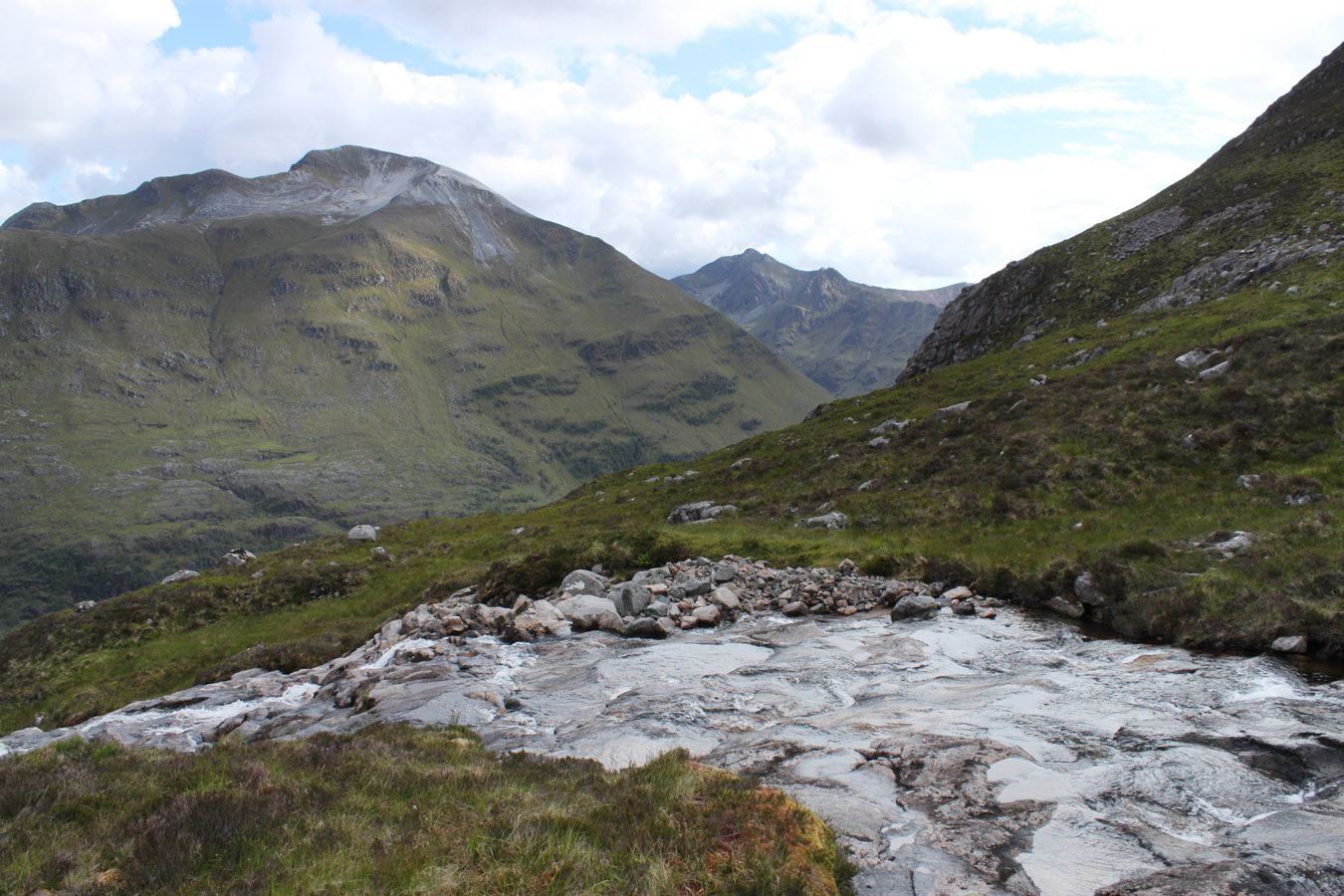
Aonach Beag
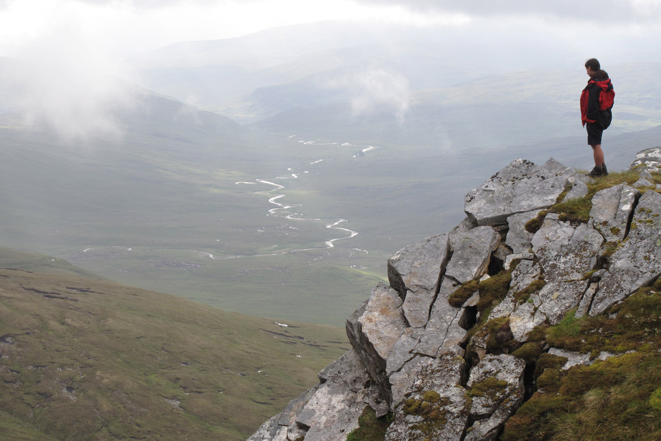
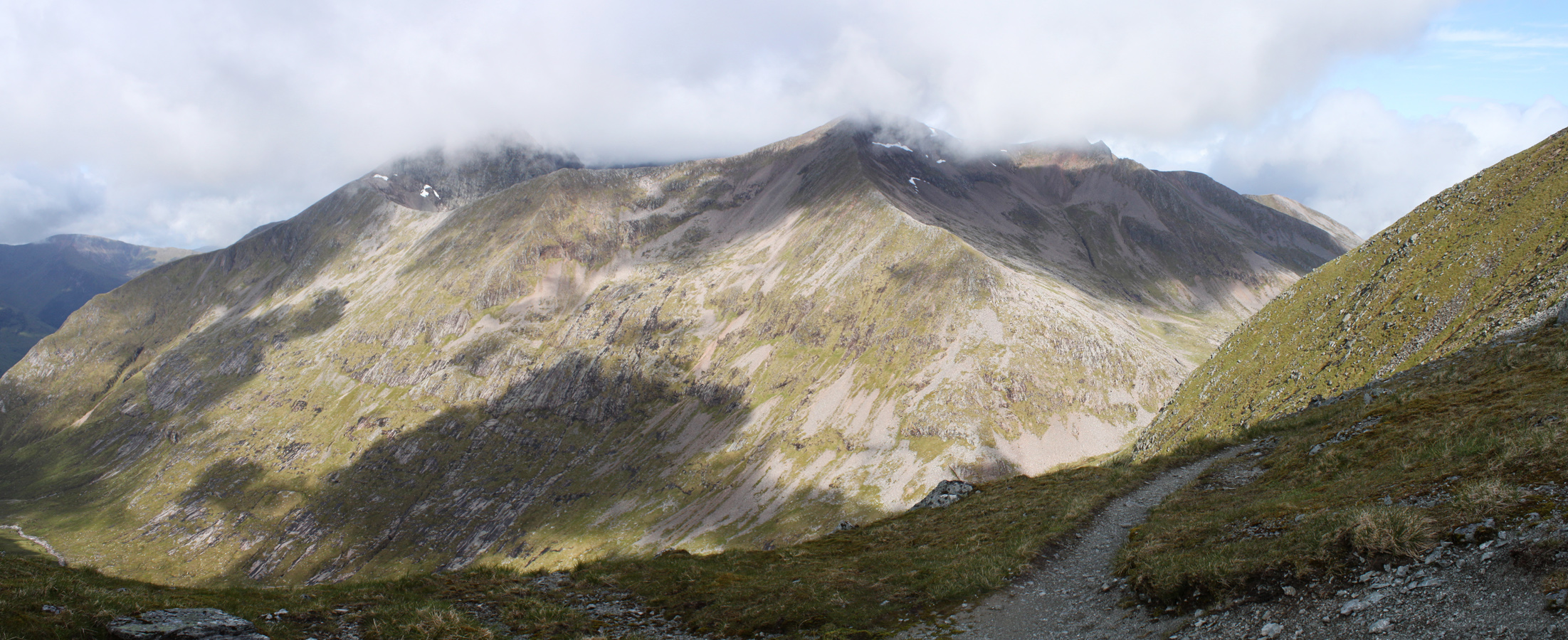
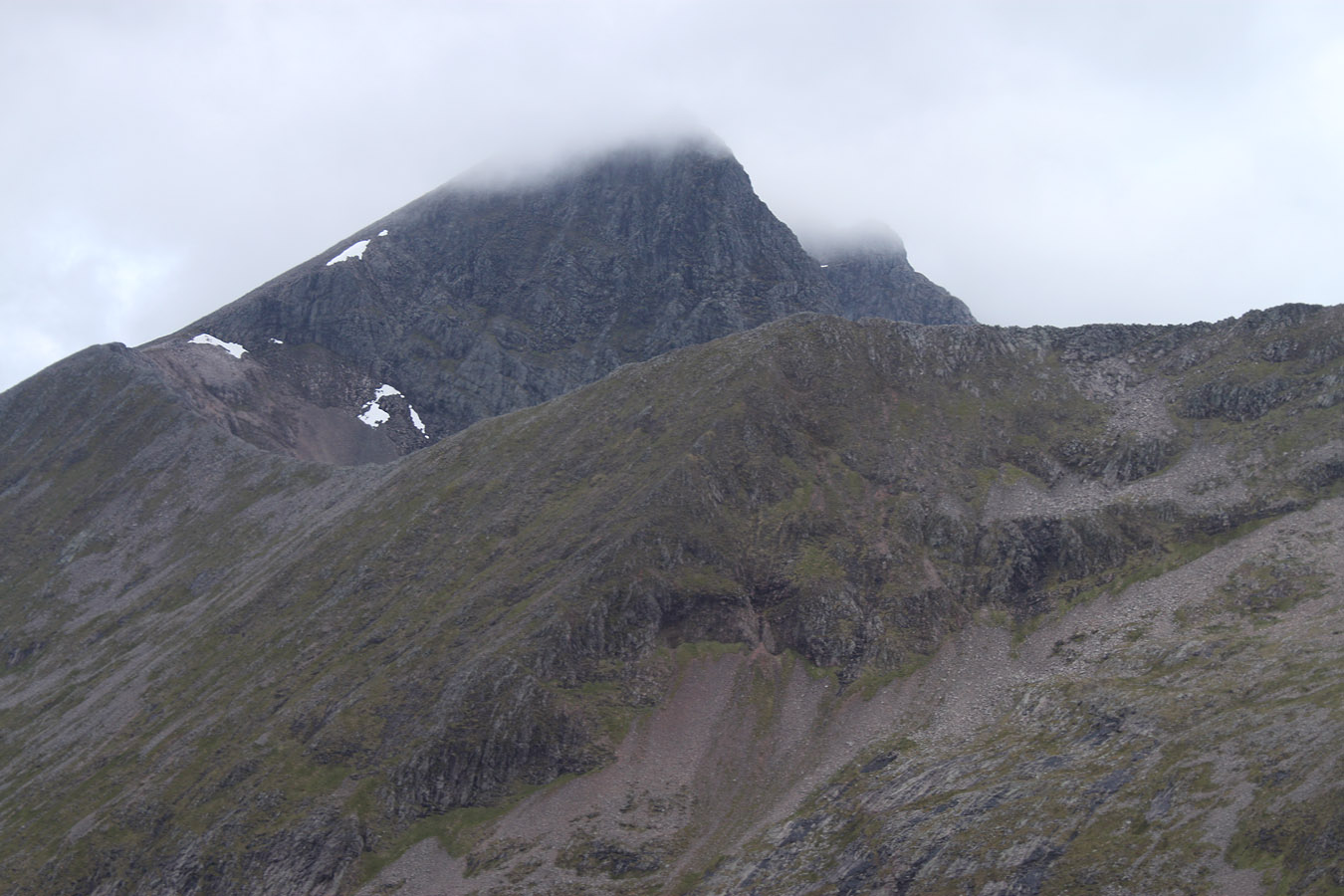
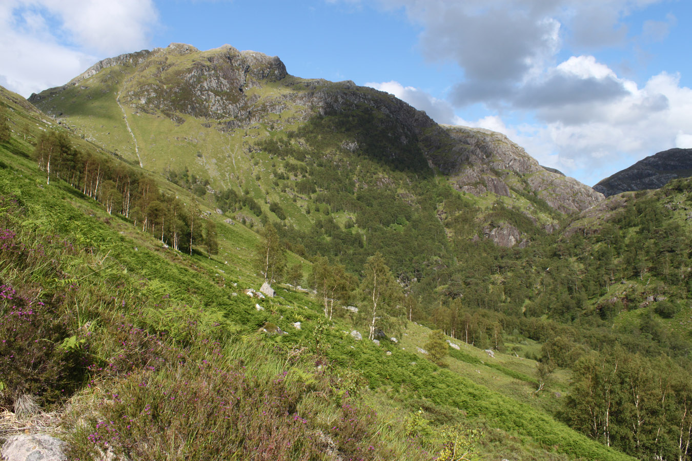
The climb to Aonach Beag had hung over our heads, metaphorically the whole trip and now literally. When Dougie had done the Glen Nevis round (over 30 years ago!) he mentioned climbing underneath an overhang and talked about the brutal-long climb to Aonach Beag's summit. We could see that overhang from the campsite and decided that would be our route of ascent. I also recognised it from one of Mackenzie Barker's photos, final confirmation that it would be possible. I asked Mac his opinion and got a text back along the lines of "steep and loose". Oh joy.
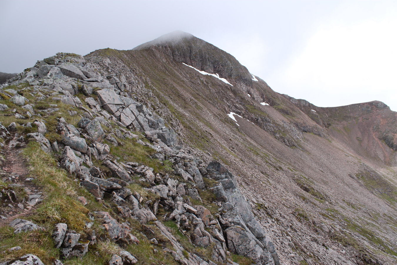
I can see three reasonable ways onto Aonach Beag. The left-most route would be to climb to the bealach below Sgurr a' Bhuic and my guess is it would offer the most uncomplicated mode of ascent. The second (central) option was the line we took, up the long gully, crowned by the overhang at the top. A third would be out on the east buttress of Stob Coire Bhealaich - a great scree fan seen from the Grey Corries. It looks a bit suicidal although probably possible if you don't mind your scrambling on the grassy variety.
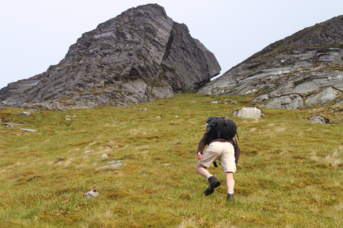
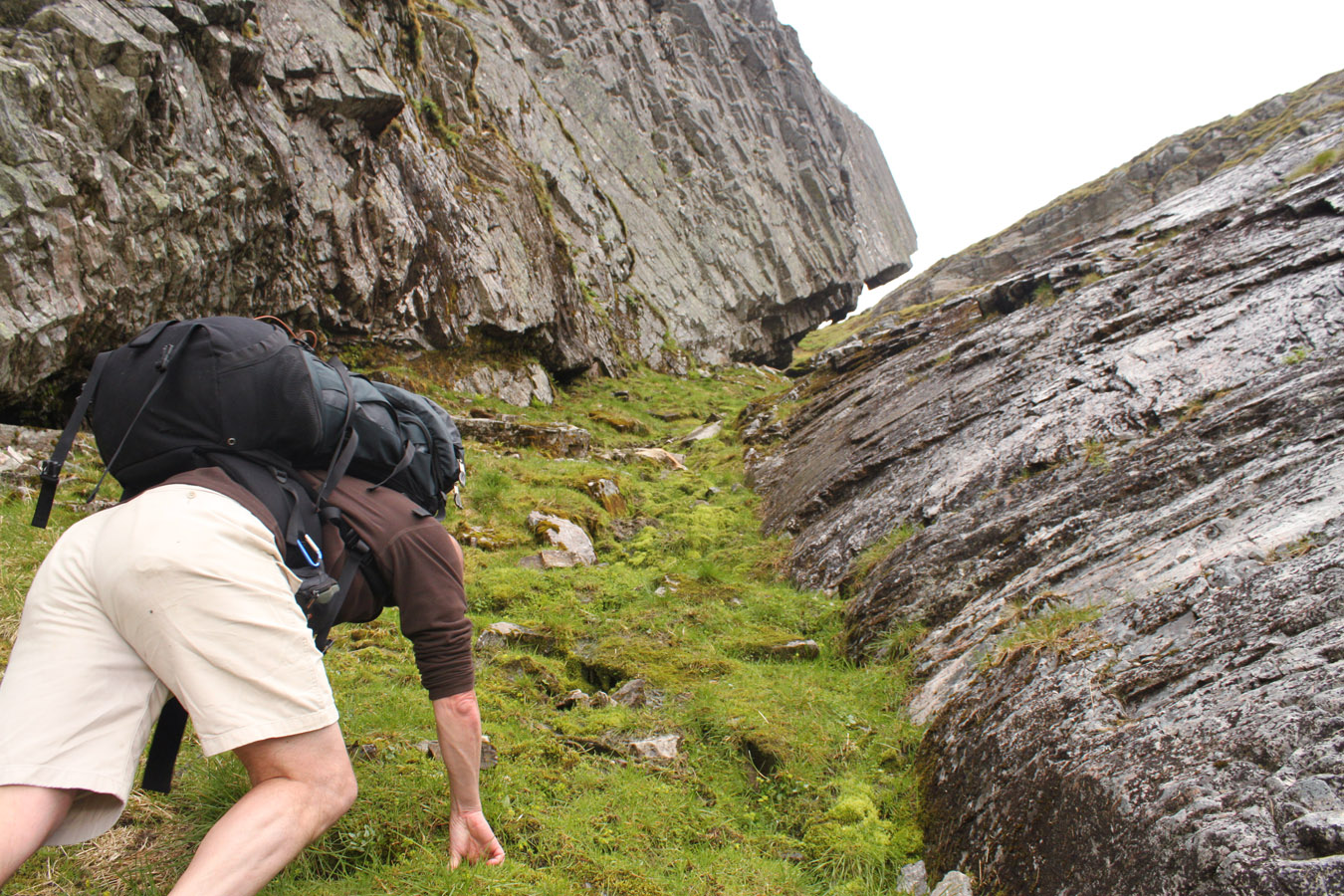
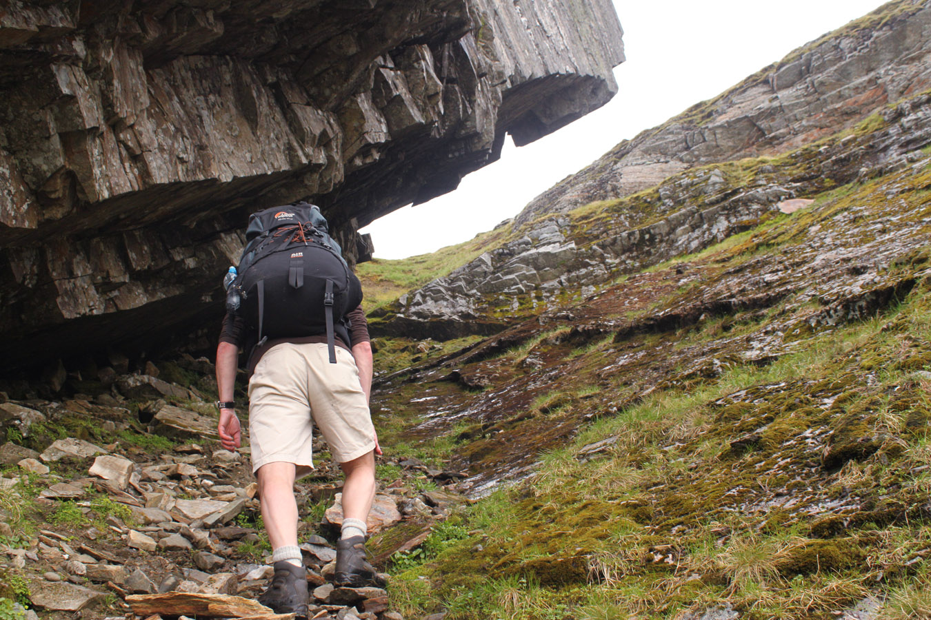

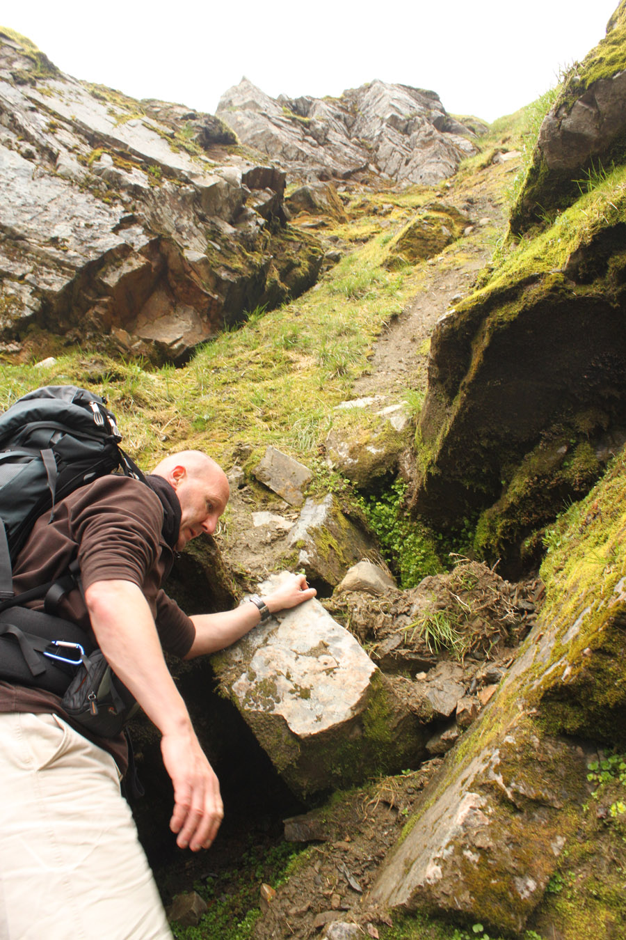
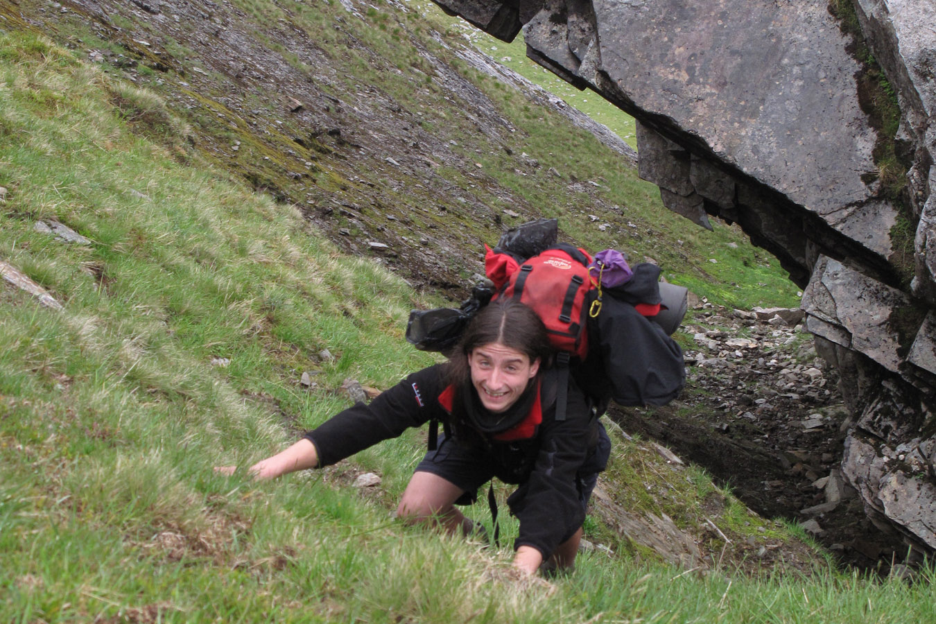

A plod up a grassy fan brought us into the teeth of our gully-with-the-overhang. Mackenzie sure meant 'steep and loose'! The gully is both of these things, and even in dry weather seemed damp and dank. The steepest part is near the top, but just climb on and things should be fine. I'd seen worse. Footholds were hard to come by because the stones and wet mud continually shift. People must kick in new holds every time.
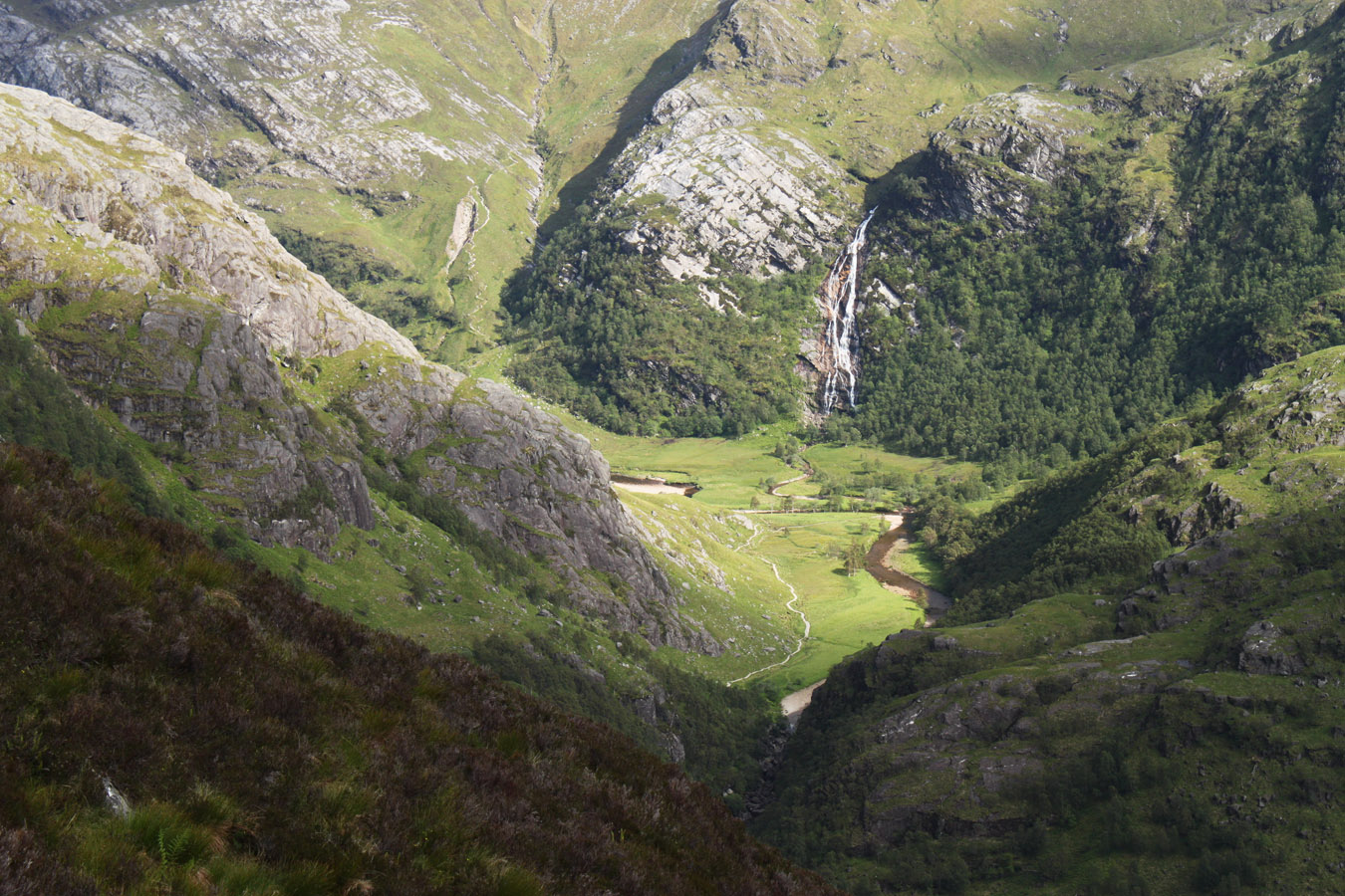
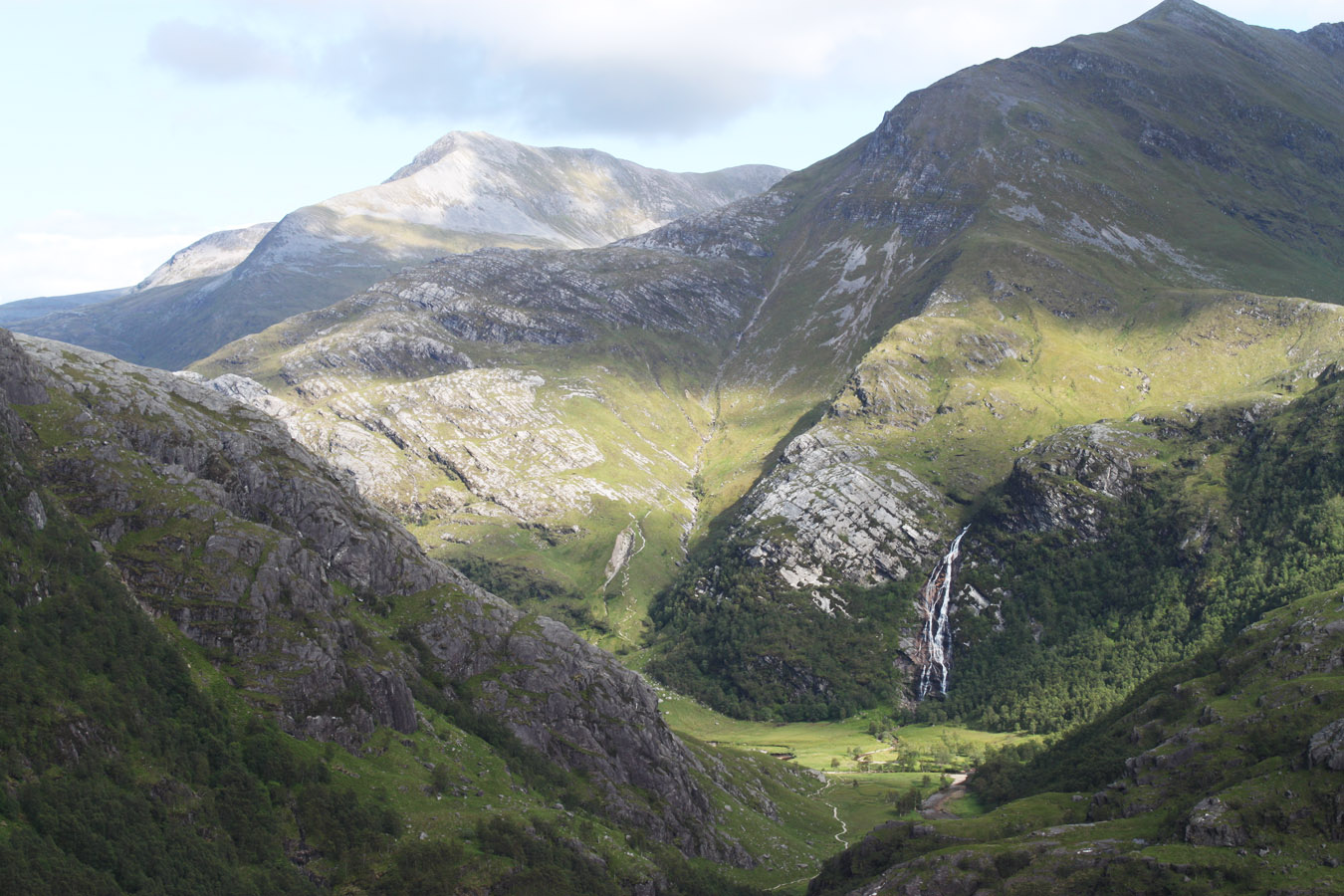
From the top, we looked down at the overhang in awe of the rock architecture. What a cool place. And beyond; Glen Nevis, sunny and peaceful. Meanach bothy (which had saved our asses two nights before) looked just a spec in a huge empty glen. The pine trees are easy to spot from afar, the buildings less so. I had to know of their existence before I saw them.
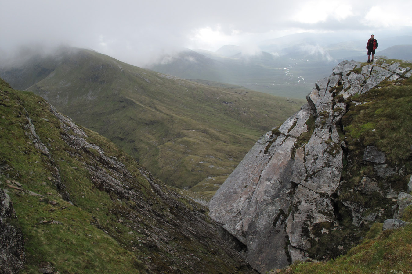
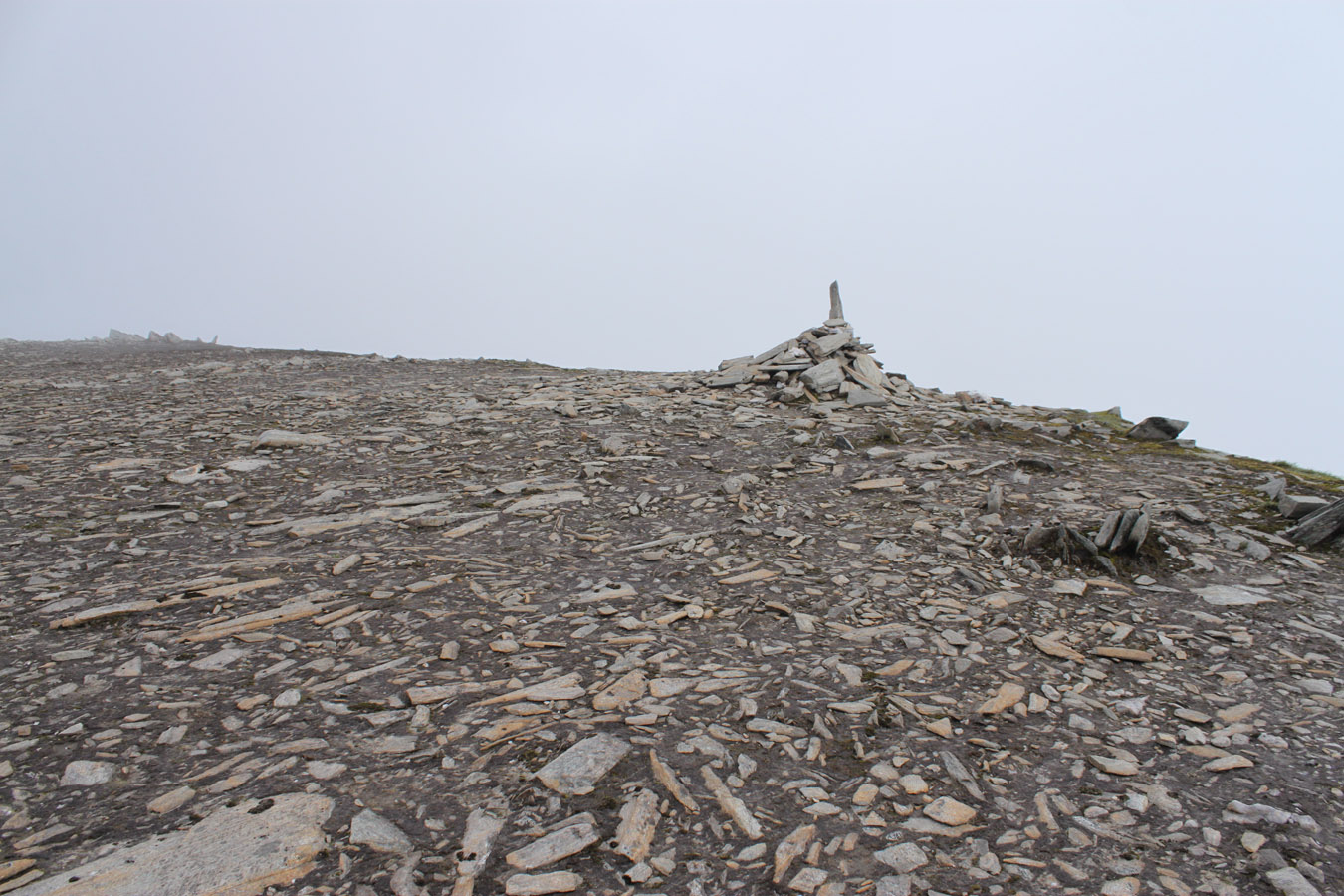
We went into cloud over Aonach Beag, ready for the long slog. A cairn signalled Stob Coire Bhealaich (a Munro Top) shortly before we walked onto the summit dome of Aonach Beag. But instead of following the ridge crest to the top, a path took us stray in the mist until were were contouring the side of the mountain! To make matters worse, the rubbish bag attached to my rucksack tore open, and I had to work some magic with the duct tape. We didn't fully appreciate our navigation mistake until the cloud lifted and we found ourselves on the SW arm instead of the SE we should have been on. Knowing our location, a short walk at a remarkably high altitude (for Scotland) took us to the summit - a cairn sitting on a plateau of moss (?) and stones. There was little plant life up here, just the mosses and lichens. I was also glad to climb Aonach Beag because my first time was in winter - where the summit becomes a cornice! Winter summiteers determine their own summit by how far they can walk toward the cornice.
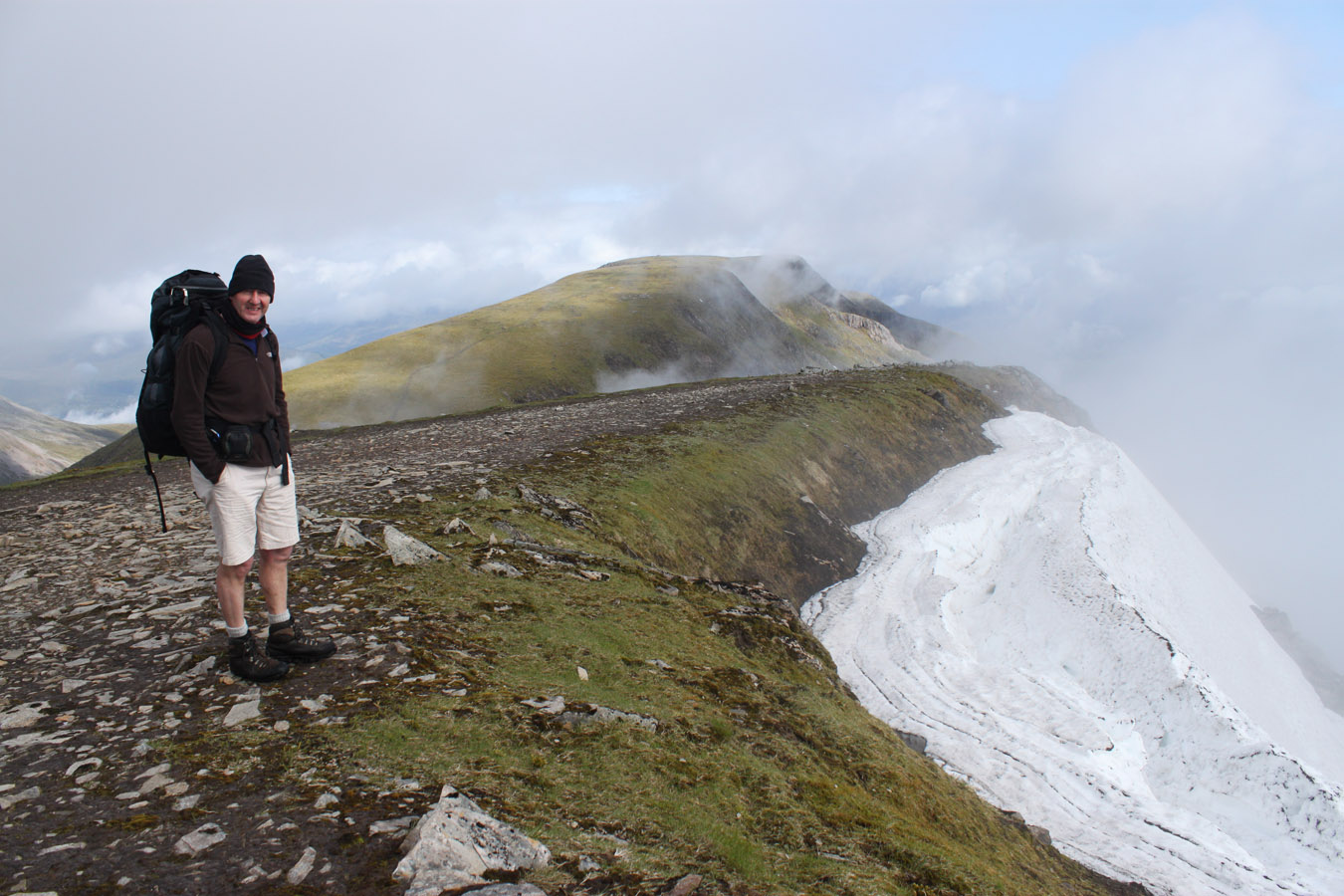
The cloud continued to lift and we even got some views over to Aonach Mor. So we headed that way (not without a play in the snow first - on my part) and dropped the rucksacks at the bealach.

Aonach Mor and Descent to CMD
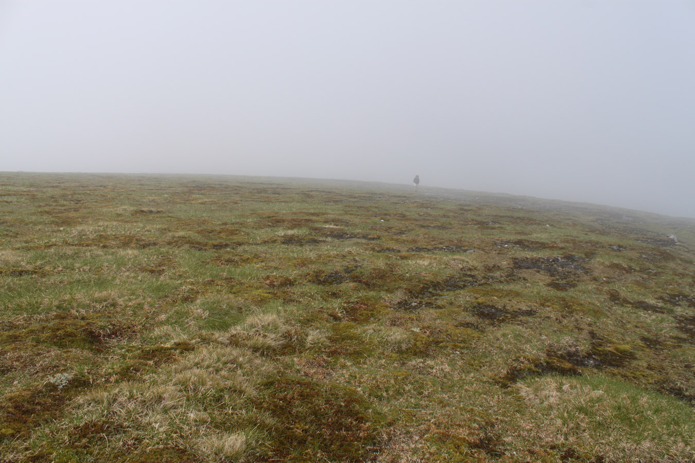
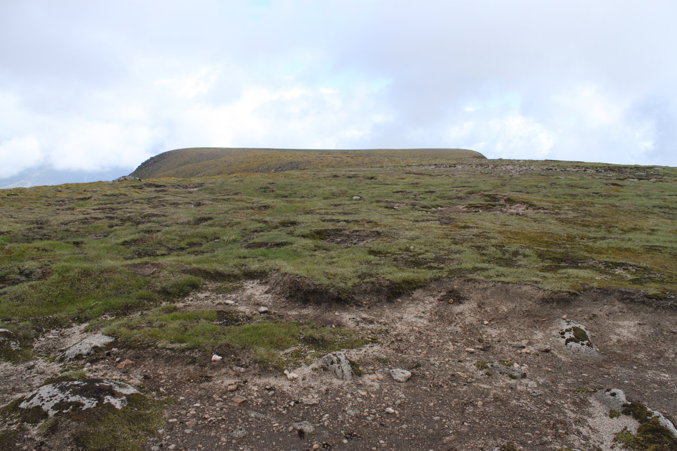
Aonach Mor's plateau is a runway of grass suspended in the sky. The first and only time I climbed the Aonach's was in February, in the middle of a cloud. Today we could see the lot, since the Nevis Range seemed to be clearing of the cloud. Surrounding mountains were cloud covered, as if we were in our own bubble. I arrived at the summit cairn, looked northwards and the long plateau seemed to rise again. The map assured this was the top, although it didn't feel it. We had time on our side, so we walked over to the end of the ridge until the ski centre tows came into view. Then we headed back to the rucksacks.

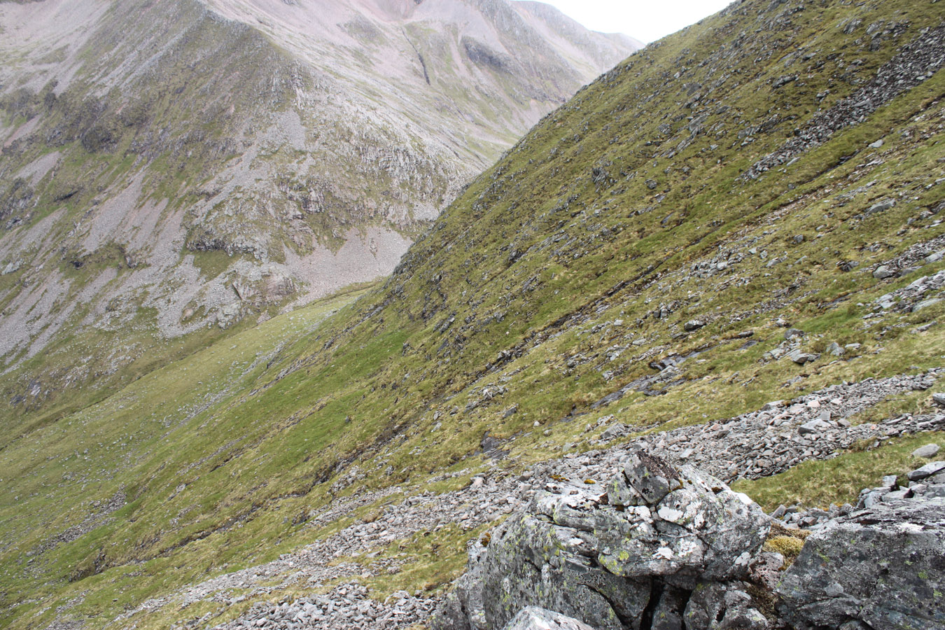
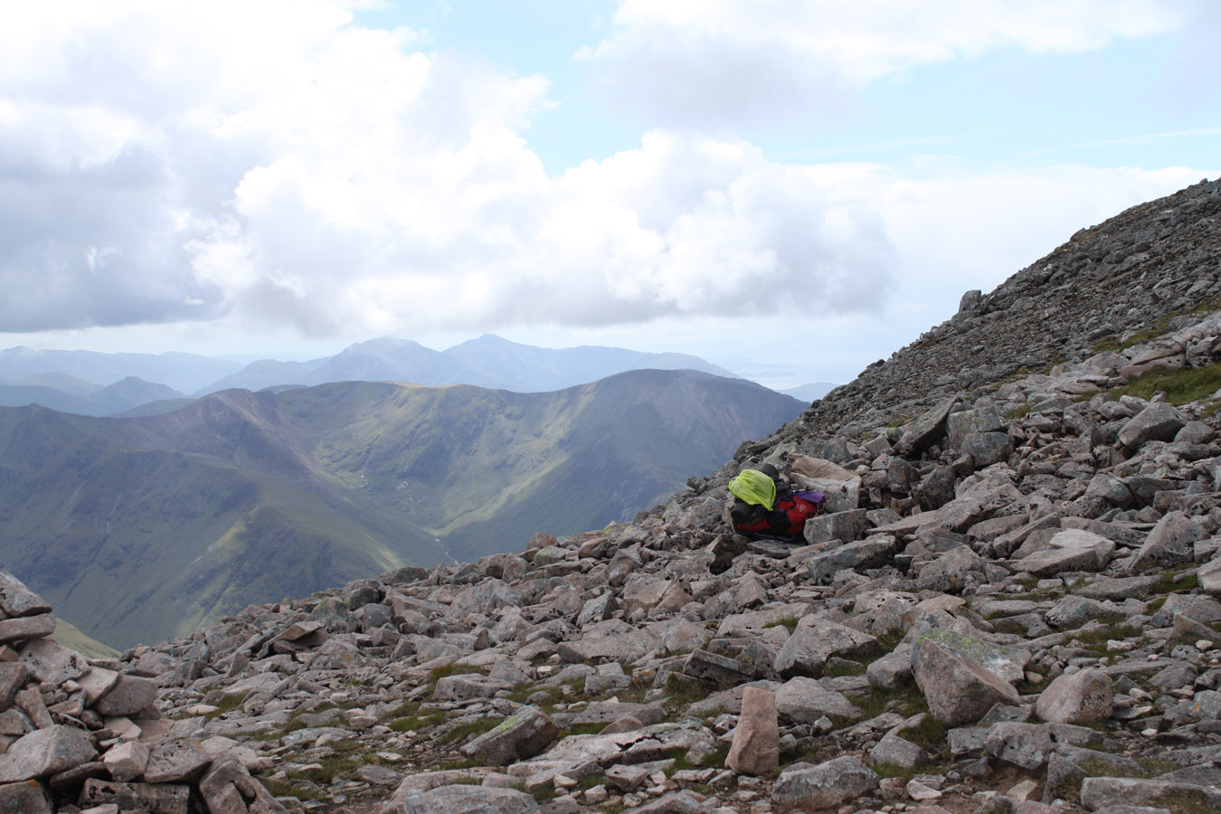
The steep descent from Aonach Mor was another of these points that wasn't so bad as I'd expected. This was happening again and again - the Devil's Ridge, An Gearanach and the Aonach Beag gully had all proved to be just fine. Once we began descending Aonach Mor, I realised this wouldn't be so bad after all and slow steady progress through scrass (scree and grass?) would see us through. We filled our water bottles at a stream, the first water seen since Meanach.
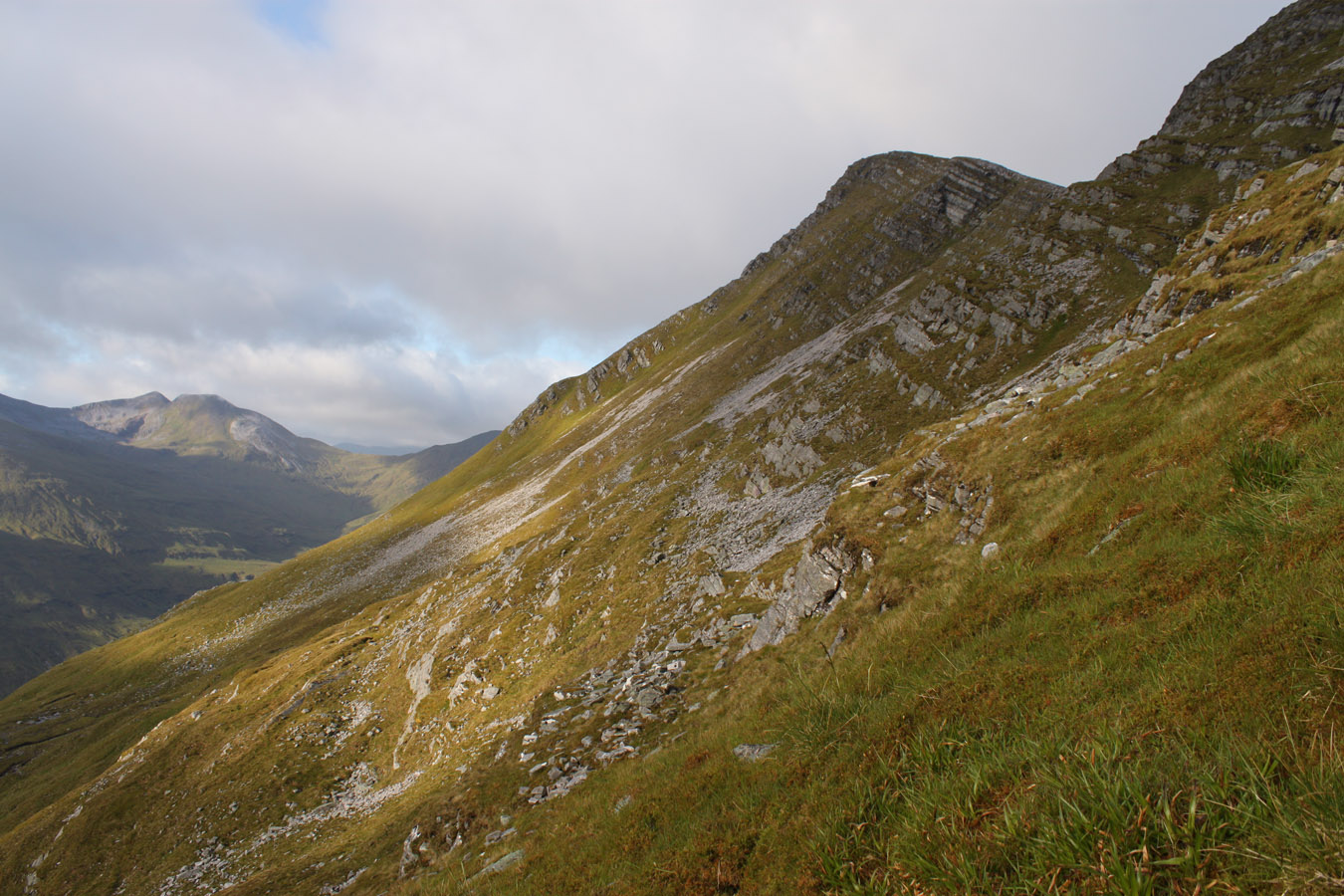
We arrived at the bealach towards Carn Mor Dearg - you have to walk through the bealach a little, south to north, to find the path on the left hand side. it climbs to Carn Mor Dearg by a dry stone wall, built from light granite. We stopped for a break here, and I took my boots off again. Ever since the Meanach/Luibeilt river crossing, water would soak into my feet and I'd periodically stop to air them out.
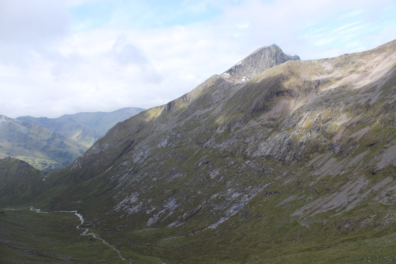
Carn Mor Dearg + Meadhonach
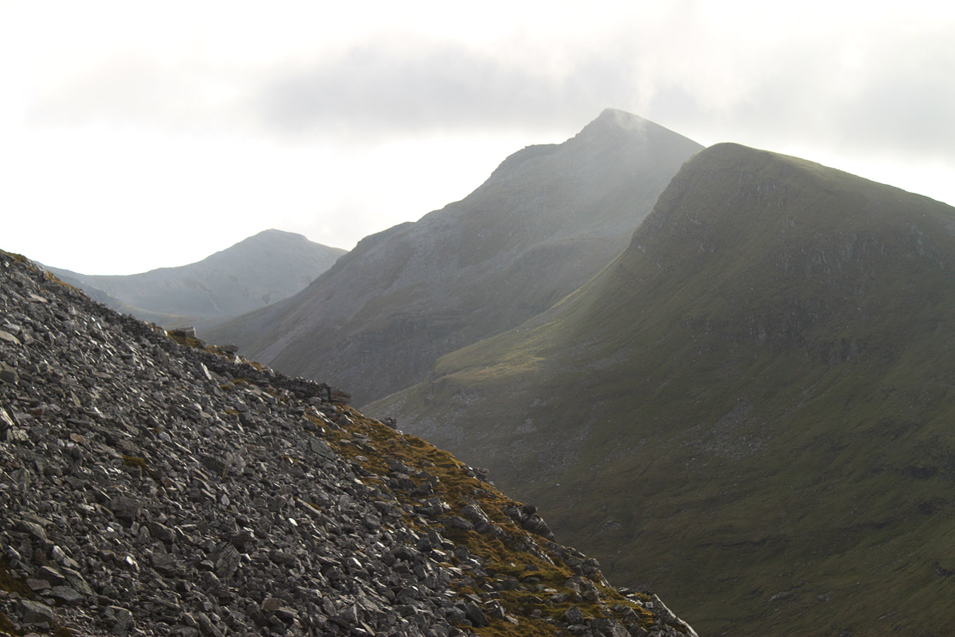
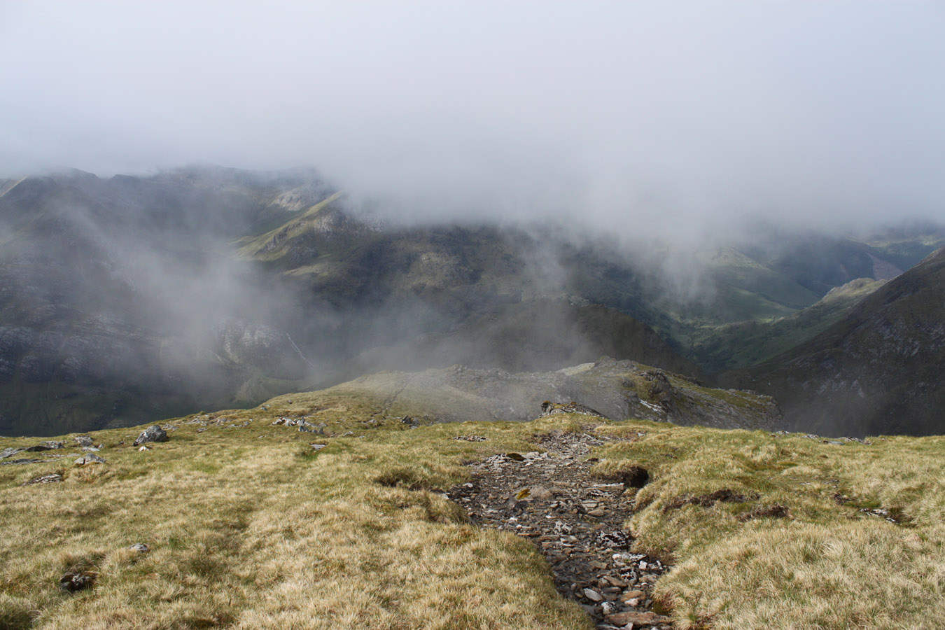
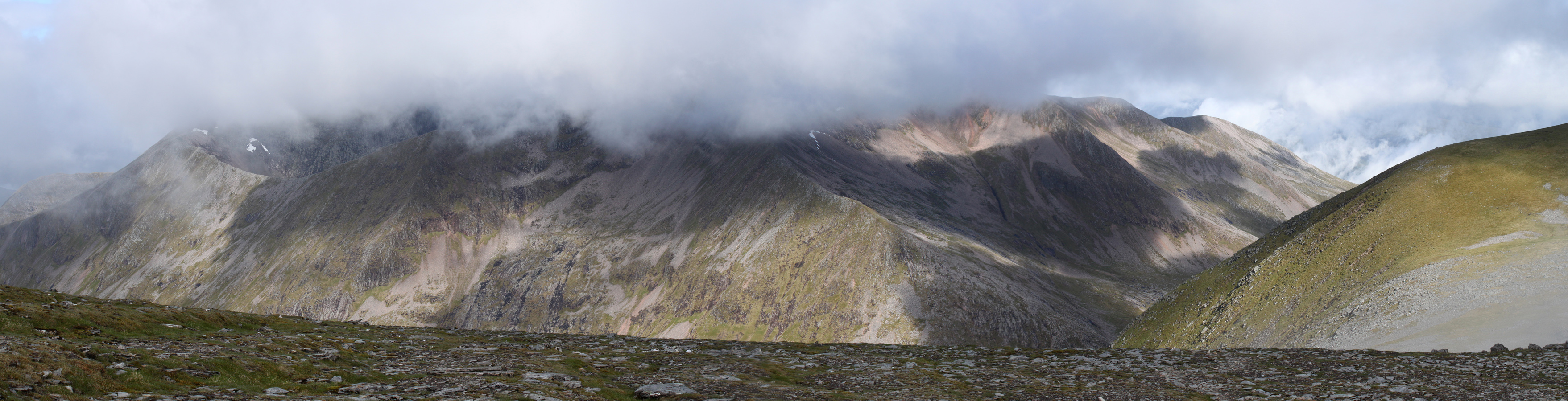
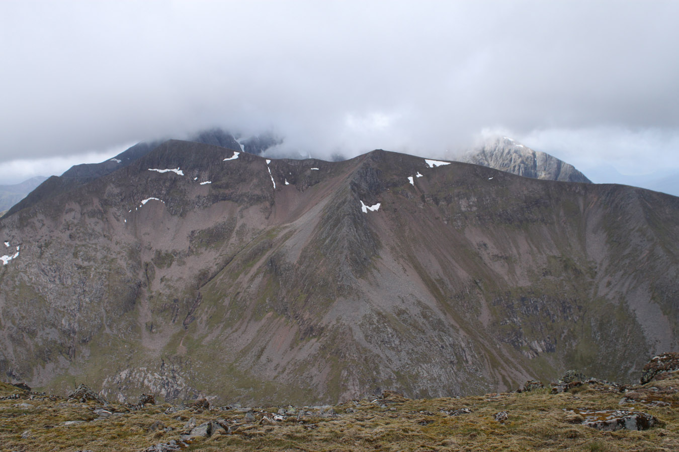
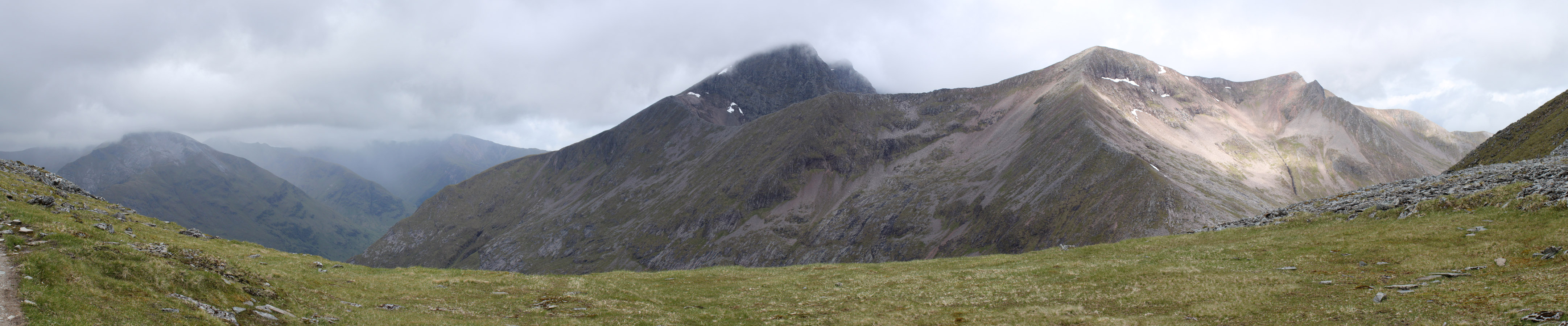
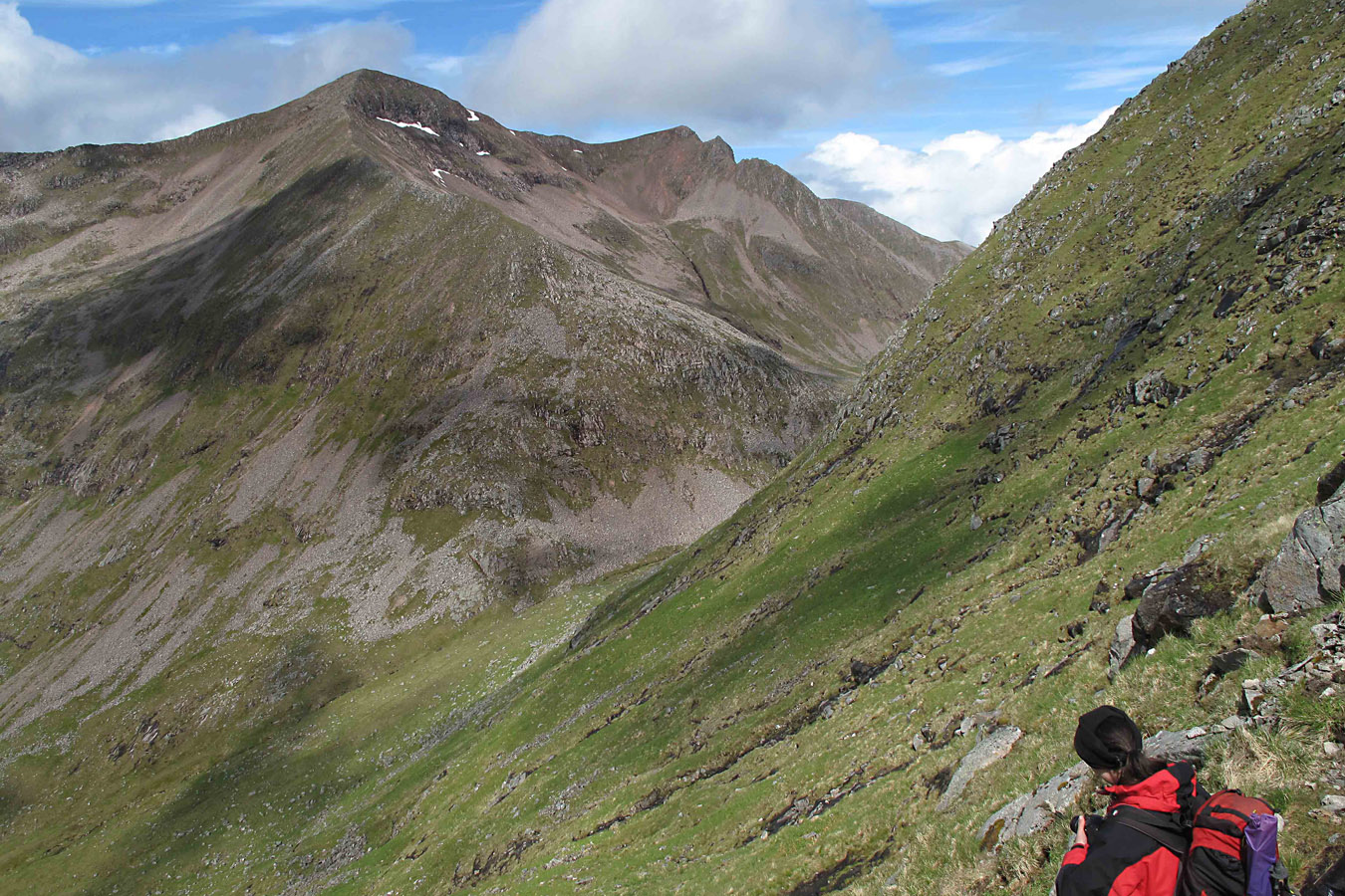
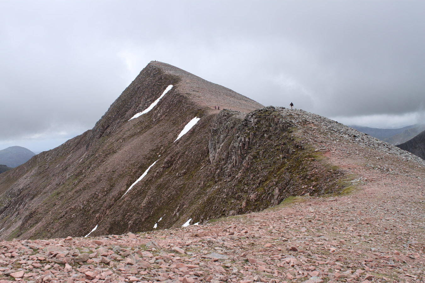
The emotional climax of the day was about to arrive. Dougie set off for Carn Mor Dearg and I followed five minutes behind. I reached that beginning-of-the-end stage (although Fort William still felt a long way off) and came to comprehend the achievement. I was listening to music too, powering up Carn Mor Dearg east ridge past Dougie, plodding on at a rate fast enough for me to take surprise. Carn Mor Dearg opened up ahead, Carn Dearg Meadhonach's serrated teeth lay to my right; the Carn Mor Dearg arête to the left.
I felt complete joy as I walked higher and higher, stopping short of the summit because I thought Dougie might want to see my expression at my first close sight of Ben Nevis' North Face. Joy and fulfilment was the order of the day. I knew I might not have another trip quite like this for a long time...
And then there were the people. First, stick figures were all we saw, starting along the arete. When Dougie and I climbed the last metres to the summit, we just missed a couple of guys starting the arête. We hadn't spoken to anyone else but each other for three days. The only people I saw for that time was distant figures high on the Grey Corries ridge, who eventually vanished into oblivion. To suddenly meet people everywhere is an experience.


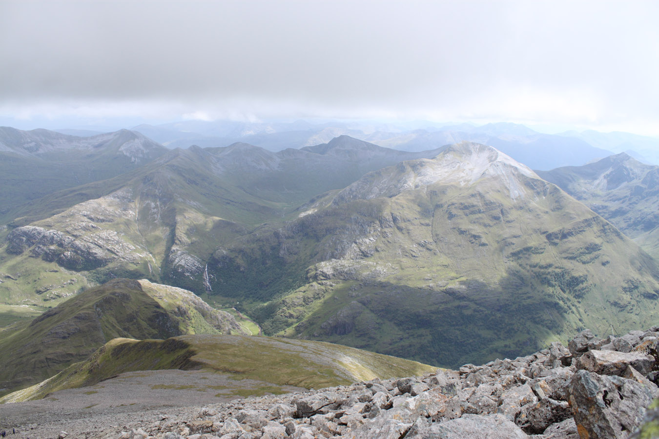
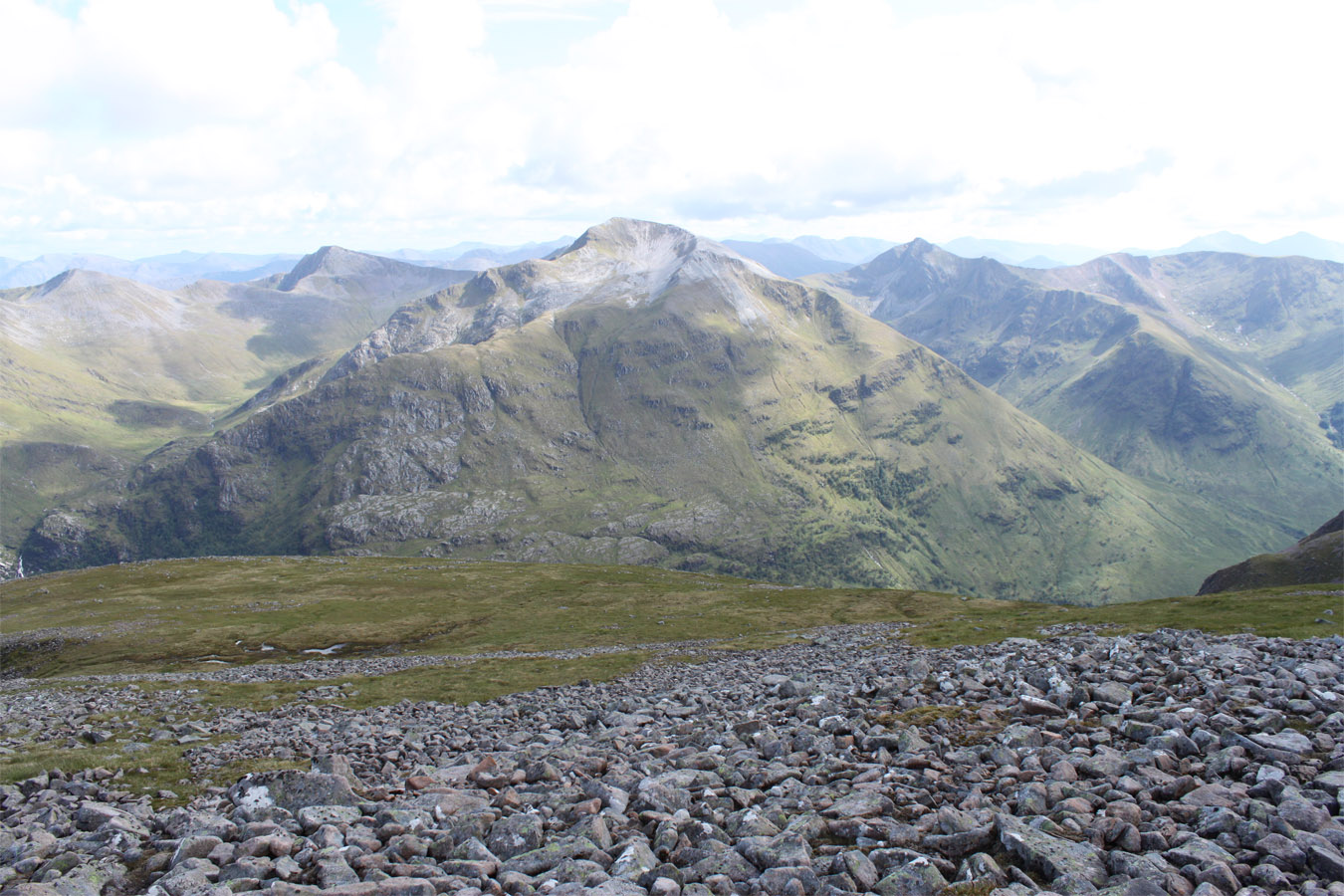
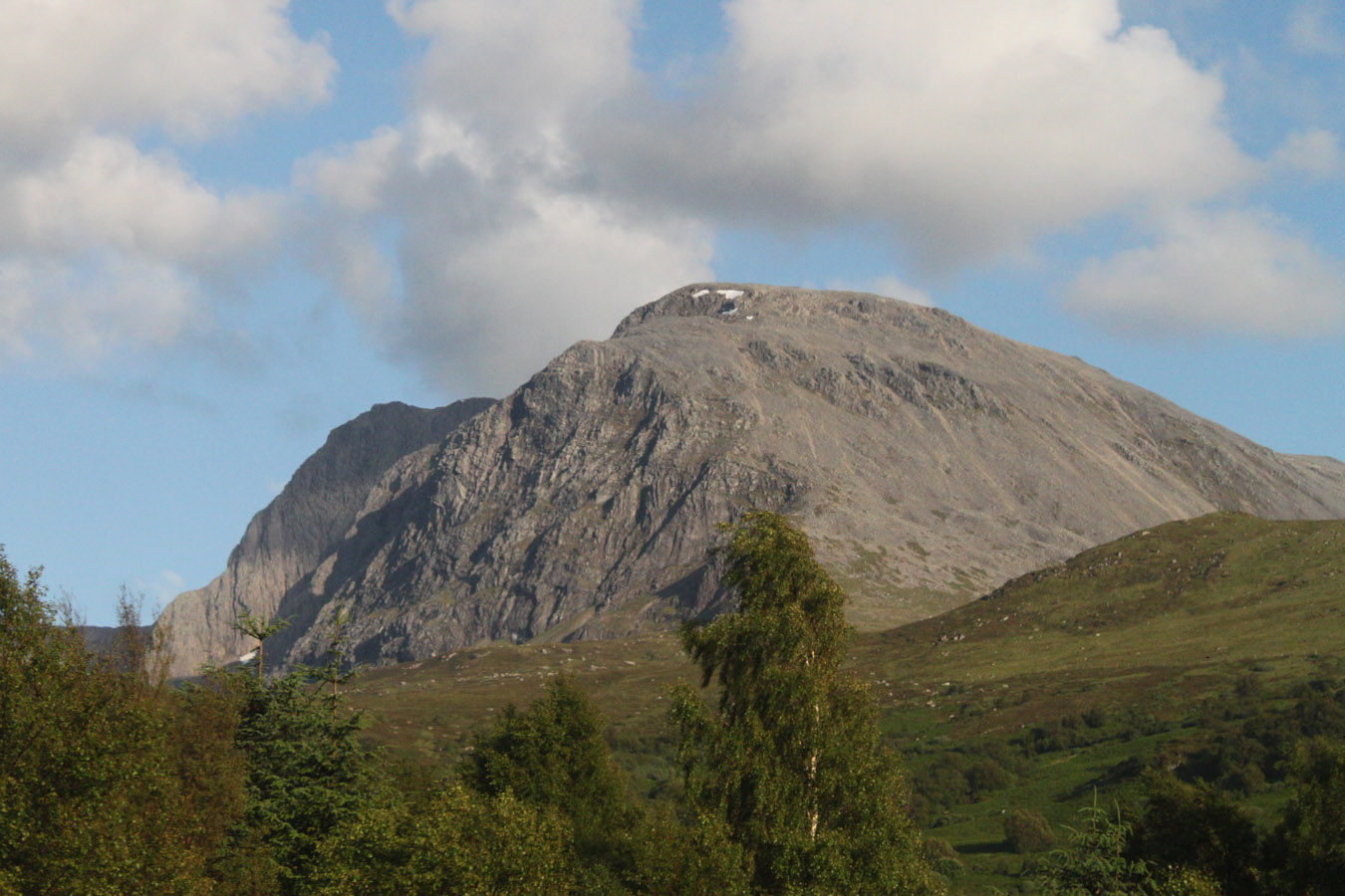
And then Ben Nevis came into view. My first impression was it looked like a photograph. When I said that to Dougie he replied "He he, I was thinking the same thing". It was just like the large print above the Blackrock Cottage fire place. And it was big. Dark and savage. It was impossible not to be drawn to the intricate buttresses, gullies and faces. Time and time again, I hear people say, "Ben Nevis is unlike any other mountain in Scotland." And they're right.
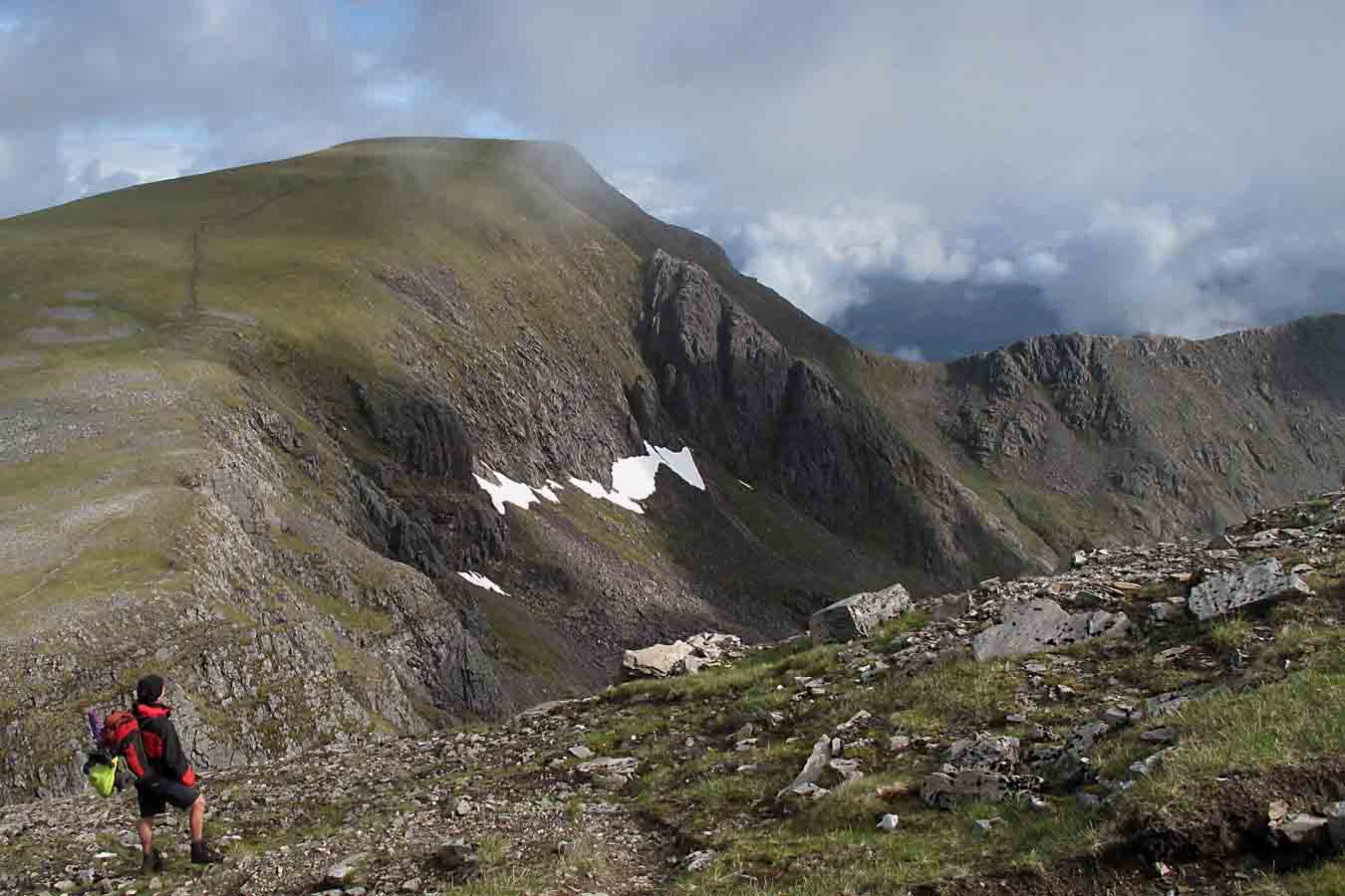
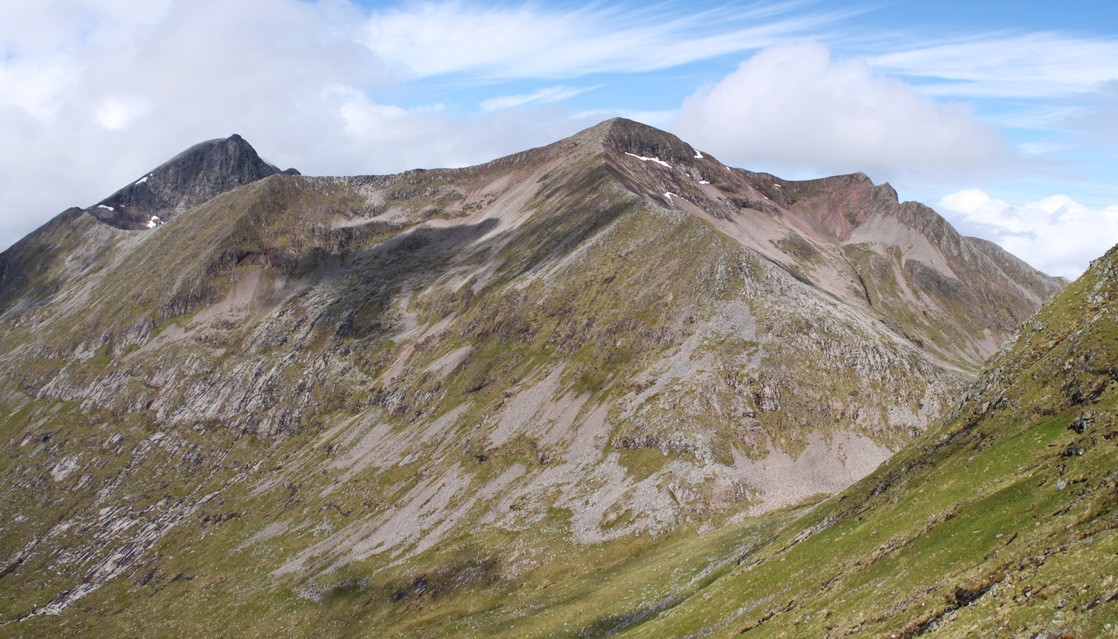
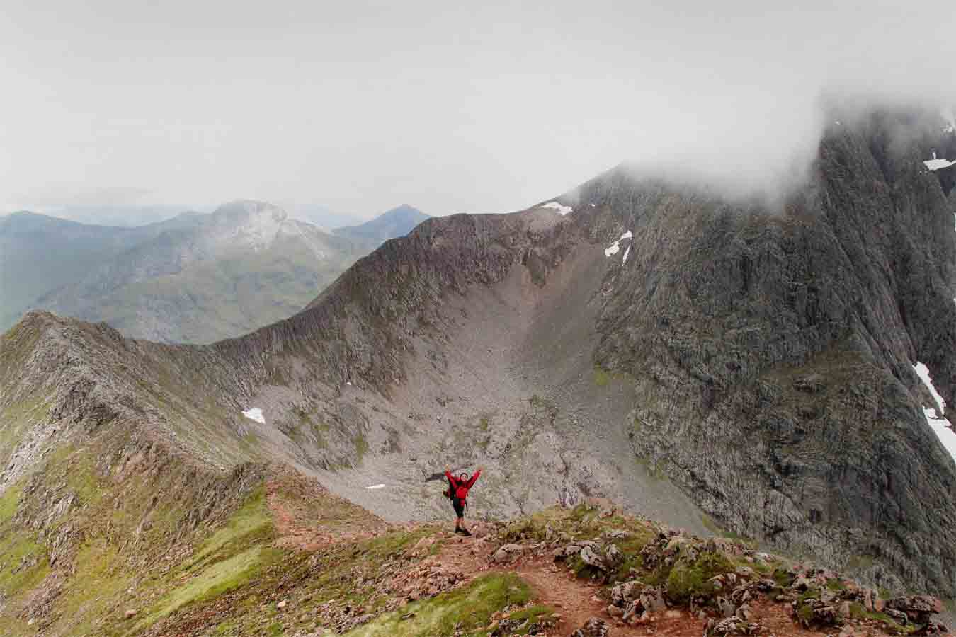
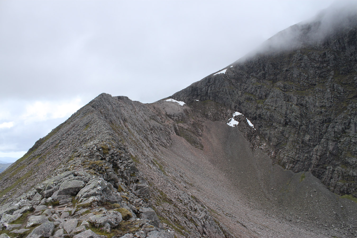
We nipped out to Carn Dearg Meadhonach, a good idea for multiple reasons: to do the Carn Mor Dearg arete more entirely. To have a close look at Meadhonach East Ridge. To climb a Munro Top. It was a pleasant boulder hop to the summit and plenty people were coming in the opposite direction. Carn Mor Dearg is a beautiful, benign pyramid from here. Ben Nevis is just brutal. It didn't even fit into my viewfinder.
Carn Mor Dearg Arête
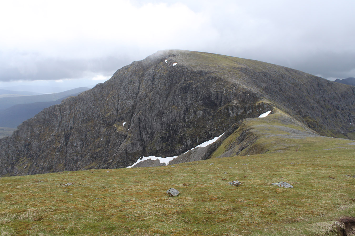
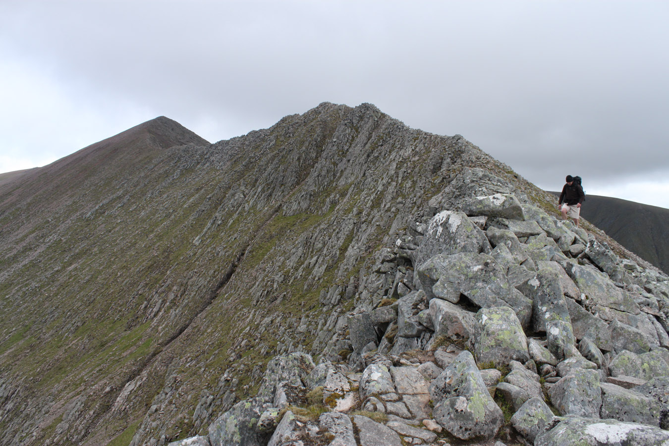
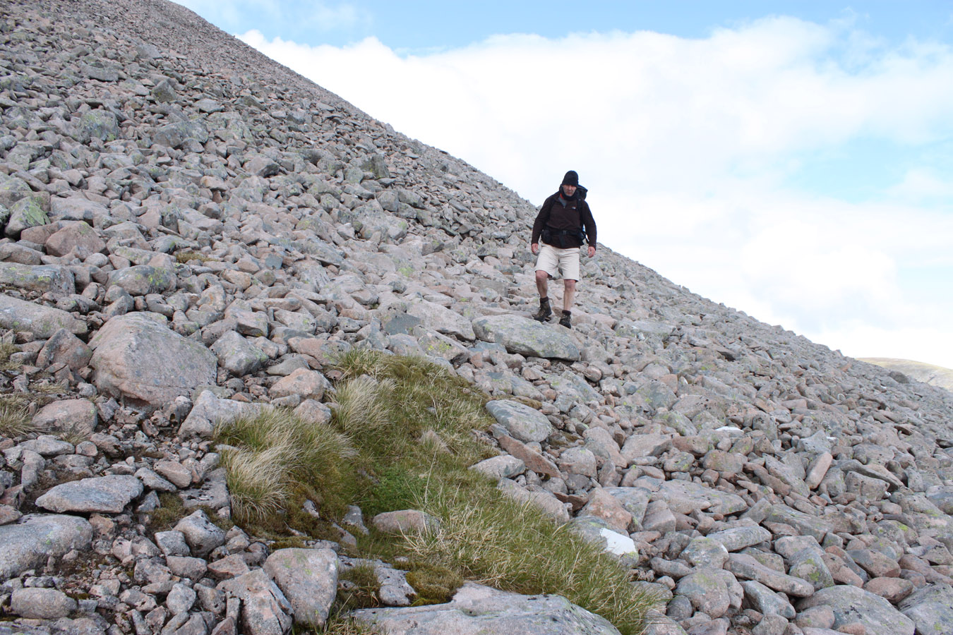
We picked up our rucksacks on Carn Mor Dearg and set out across the arête. This is such a classic route, a knife edge sweeping in strokes as if it were painted. It is also very, very fun to climb along the crest. Again, this was another area I didn't feel didn't deserve the fear it attracted. It's just a one of a kind that should be taken along it's crest by those with enough energy to care. There's a path alongside the steeper bits, but where's the fun in that? I pranced over crampon-scratched boulders, each move hardly worthy of being a climbing move - but asking coordination and balance. It would make a superb rooftop run without the rucksack. I would be tempted to consider a winter traverse and I'm betting it becomes easier banked up with solid snow.
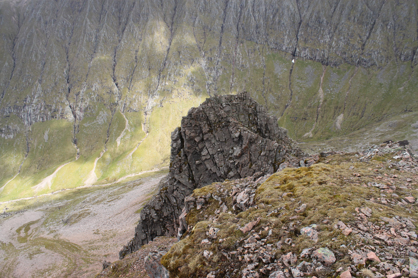
Hi-resolution image of Carn Mor Dearg arête and Ben Nevis' North Face, with annotations
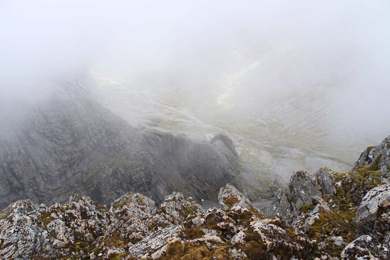
Speaking in terms of exposure, the narrowest section is near the end, toward Ben Nevis, which is only a walk along a bench-sized platform with drops off to either side. I think something would have to go wrong to fall off the arete, and most of the fall-lines extend maybe 5 metres - hardly death-potential.
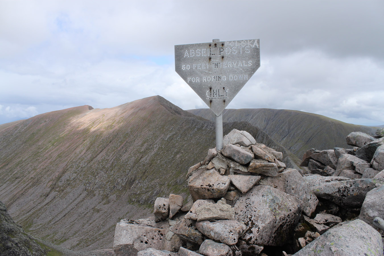
At the far end of the arete, we dropped the rucksacks beside the abseil post.

Another observation about Ben Nevis: for all it's unparalleled cliffs, there's a lot of clutter lying around. It's easy to see the heavy usage it receives. And there are a lot of people on CMD, which was surprising for not being the normal route.
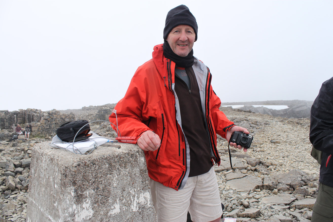
I waited on Dougie for the final bit, and continued the break in the sun. I'd been concerned of worsening weather earlier, but now the weather was only improving. It was crazy to think the last summit was just above and at last, we were here. I become quite sentimental about these things. I was looking forward to the summit, although it was strange to be here in a situation I'd thought about so much over the past week.
Ben Nevis
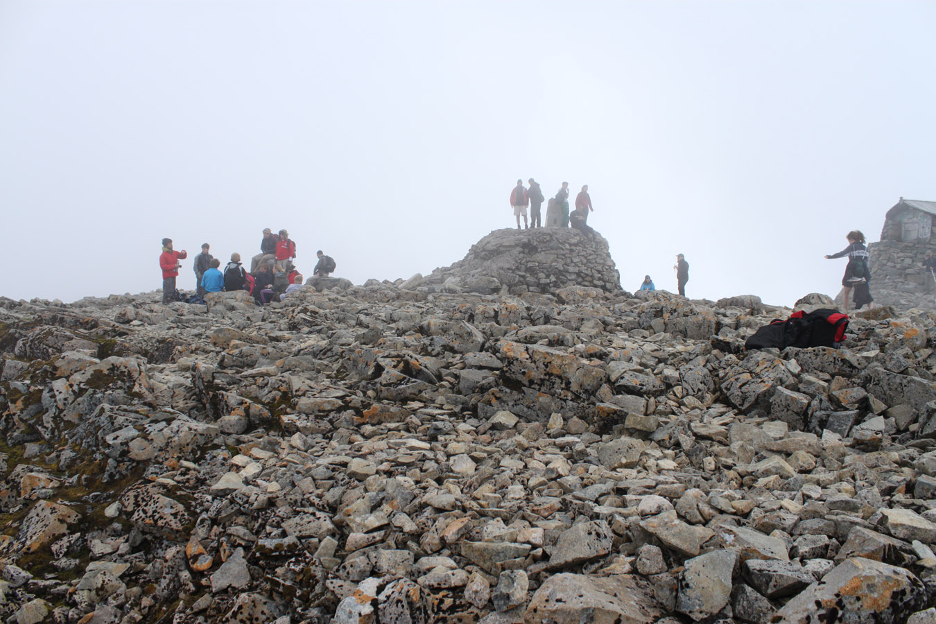
We started up the boulder fields, plodding away. People were descending, some above were having a look over the cliffs. There were traces of a path which faded and returned. Near the top, I paused again - I'd want Dougie and I to get to the top at the same time, so I waited. After ten minutes, I looked down and typical Dougie was having a casual chat with some guys!
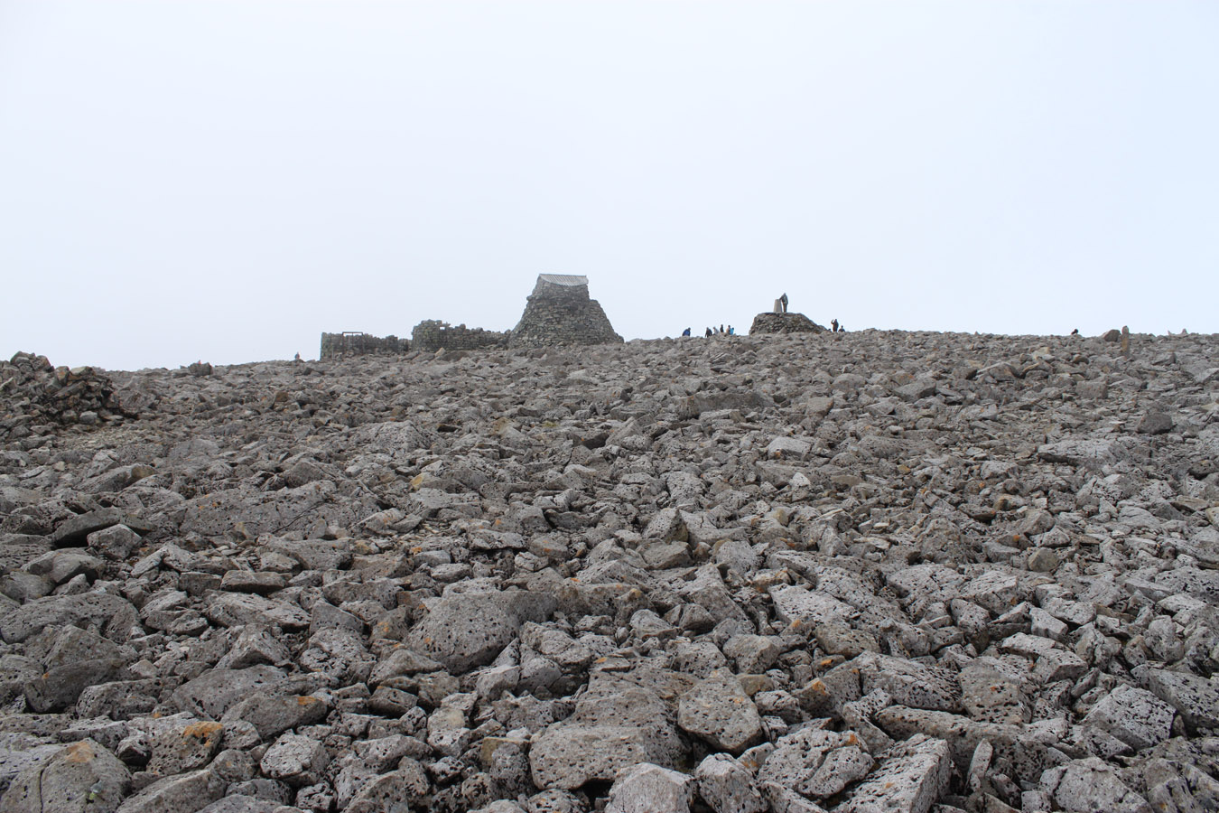
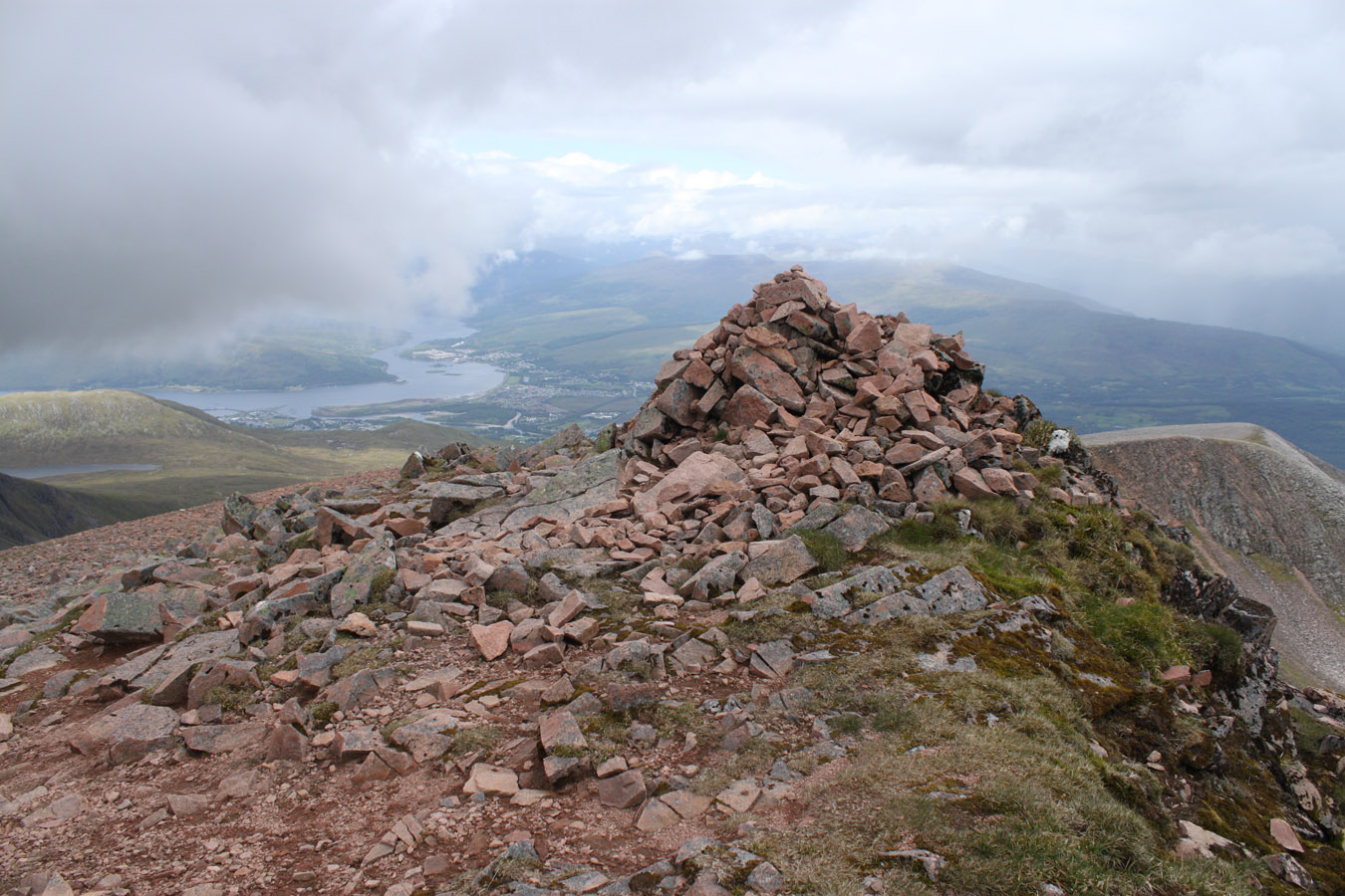
When he arrived, we came over the top of the boulder field onto the plateau - and the summit was right there, only a minute or two away. Oh, I was a happy guy - this was a moment to remember. And we walked up to the top, touched the trig point, and that was it - Glen Nevis done. Whoa. We hung around a while, chatted to a guy who was working in a hostel somewhere in Glen Spean. I don't remember exactly where. He said he was on his day off. I walked over to the cliff edge and looked down Tower Ridge, snaking all the way down to the Douglas Boulder. Thinking of the many people who have come up that way - maybe I should do it some time?
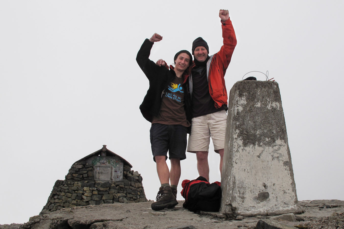
On the summit of Ben Nevis after a 17-Munro, 4 day round of Glen Nevis
A recurring experience of this trip was coming understanding these Nevis Range giants as tangible and not unattainably huge (if that makes any sense). Aonach Beag's East Face became climbable instead of shapes of scree, grass and snow, as did Carn Mor Dearg and Ben Nevis. Mountains can exist bigger in the mind than in reality. The opposite can be true, too, and at that other extreme is overwhelming enormity.
Descent
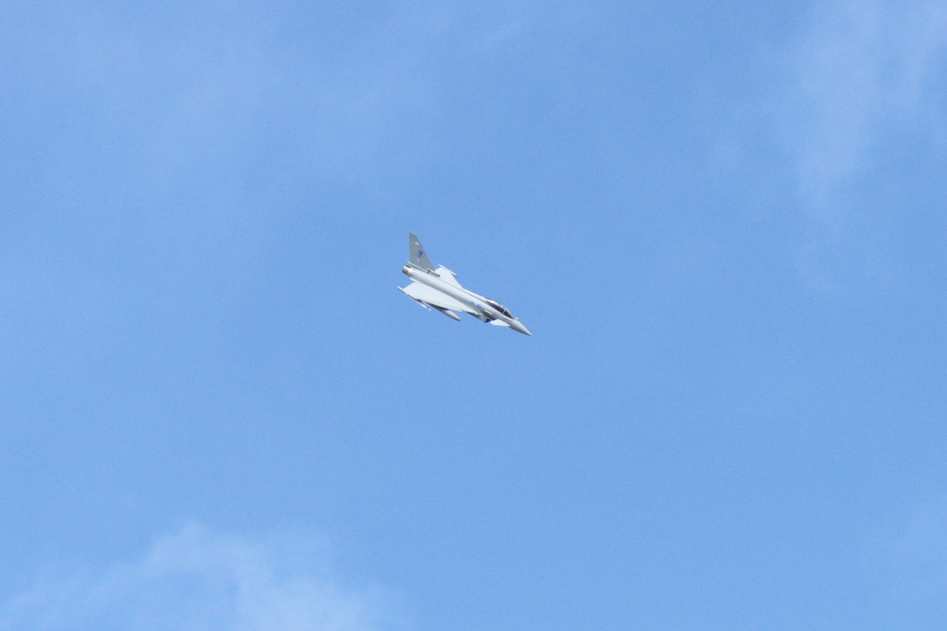
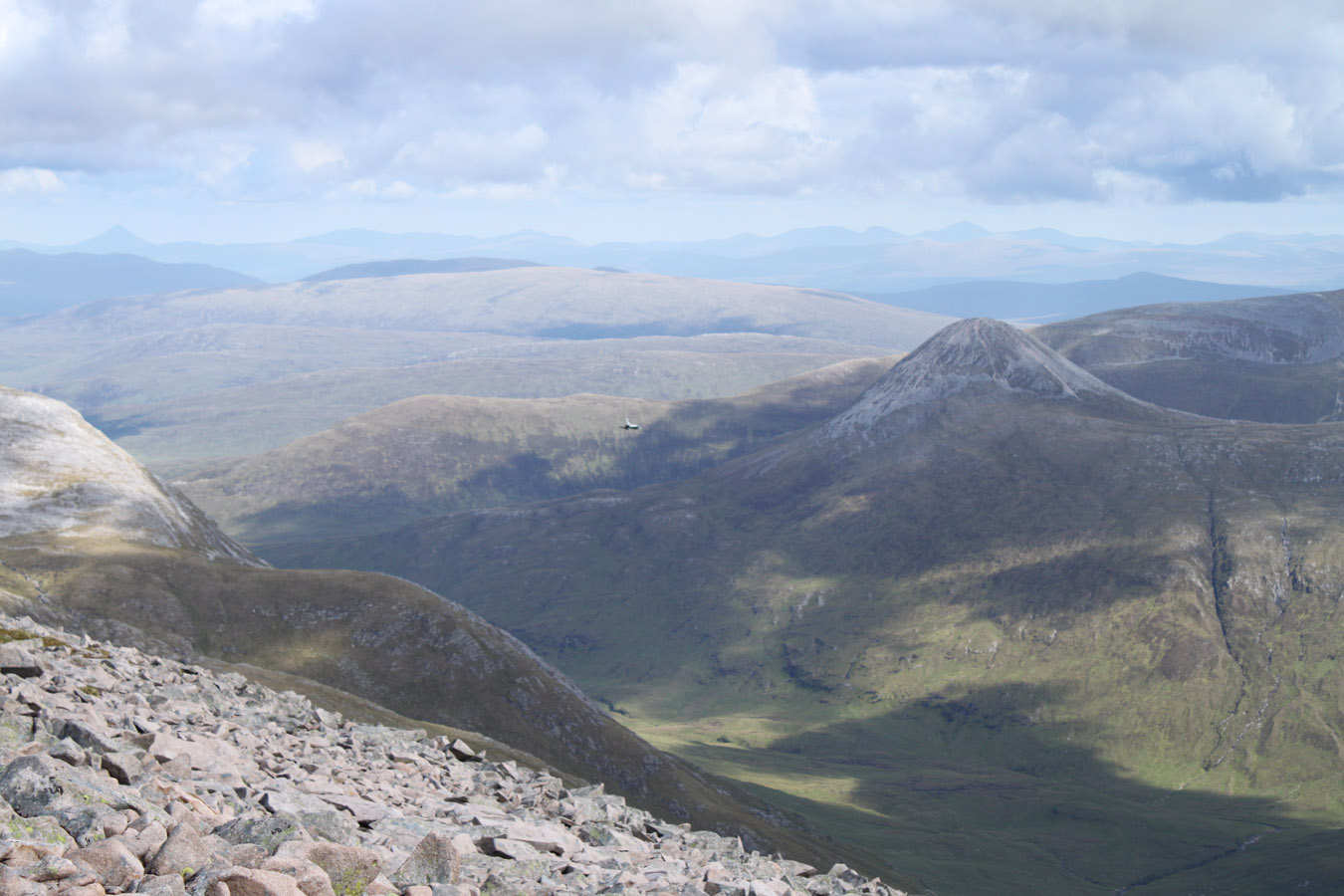
We spent twenty minutes on the summit, and accidentally strayed onto the NE Buttress before finding the descent route. Back at the rucksacks, we sat eating up the last of the food when all of a sudden a roar filled the air - a jet. Where? Then we turned towards the arête as the sound grew in intensity. A Eurofighter moved faster than I could work it all out, over the ridge and into the sky above us. At it's closest it passed just 500m away. It turned and dived into Glen Nevis, I grabbed my camera, and started clicking, but it was too late. The memory is of the plane shaving the arête, accompanied by that almighty roar. Anyone on the ridge itself must have been looking up it's intakes before diving off the side in fear of their lives! What a moment. And what a last summit - Ben Nevis - what a view to all these other mountains. For all the weariness in my legs, I knew this was the life I love.


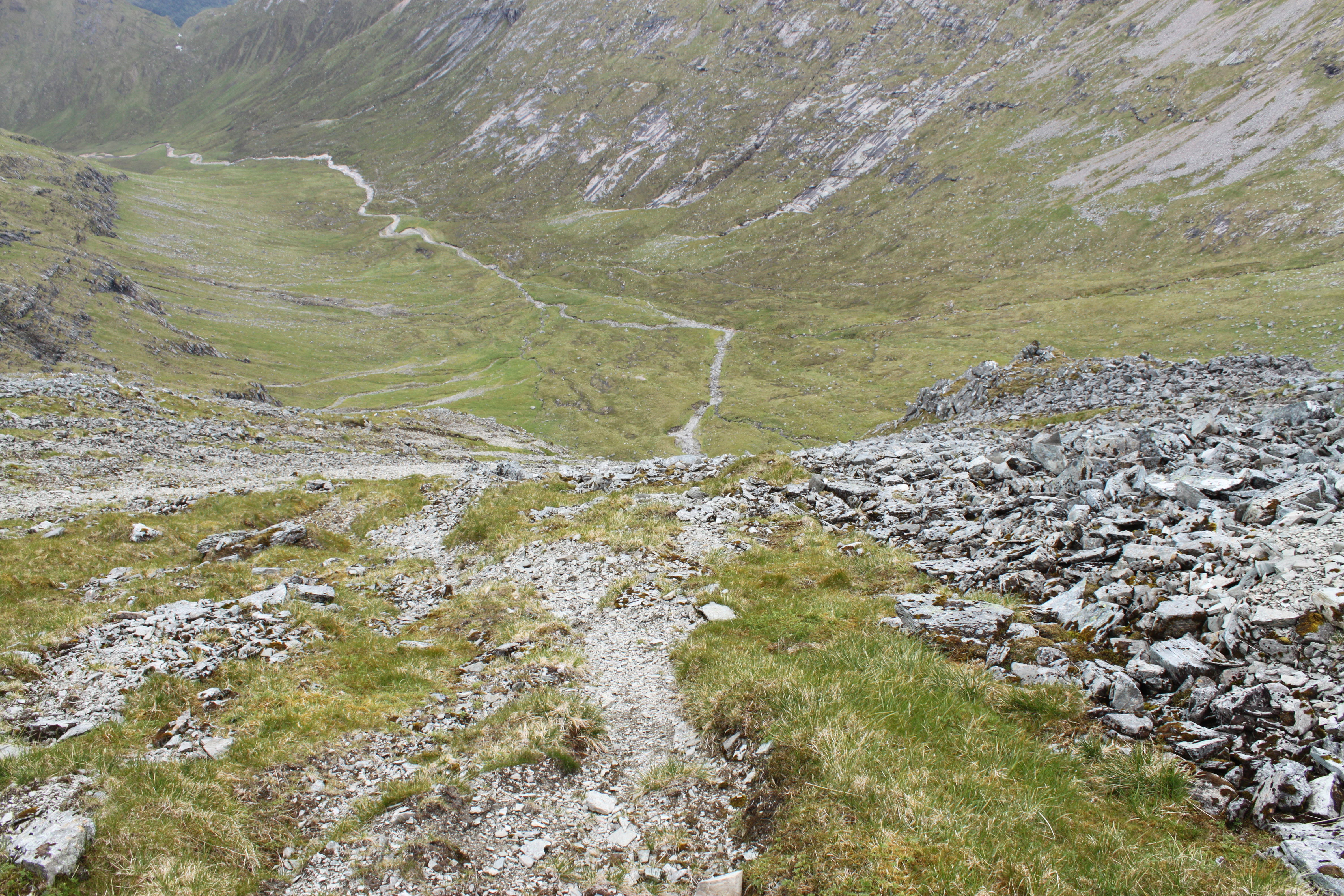
Descent was going to be brutal. Look at a map and the climb from Glen Nevis to the summit via. Coire Eoghainn must be the most contour lines crammed into any slope, anywhere in the UK. The good news is that as a route, it is very achievable. Used to being so high up, I felt 'low down' having already come off Nevis - so surely descent couldn't be too far. The logical part my my mind said I was still at 1150m - almost the height of Crianlarich's Ben More! Actually - we'd have to get a move on or we'd miss our train.
Everything was okay until the coire mouth at 600m. I was tired, but the last 450m actually took the piss. It's steep, and the path (and there is one) sometimes gets lost among the tangle of heather and granite slabs. I was glad I'd rock climbing experience and trust in my feet as I smeared down small holds on a 40 degree slab. I was glad Dougie didn't make my mistake, keeping to sensible routes instead.
The weather was hot too - the sun, pounding, made me too warm and without wishing to be walking anymore, I speed-walked or ran the final couple hundred metres down, waded through bracken and birch trees ("tick-city") to the Glen Nevis road end. I sat in the shade for an eternity while an English couple played 20 questions about my trip. After a while I got worried that Dougie wasn't coming - but he did, and finished, like me, without grace, in a bracken-battle all the way to the tarmac. I don't know where the path goes, if at all.

Back to Fort William and Train Home
The train was at 7.50pm; 40 minutes to go. If we were to be in with a chance, we had to start walking - now, putting the thumb out wherever possible. A guy picked us up five minutes later. We crammed ourselves and gear into his little van (or was it a car?). He was a mountain guide, taking a group of school kids up the waterslide route to Ben Nevis and was now returning home. That's a brutal route to take them, I thought. I had trouble enough going down it!

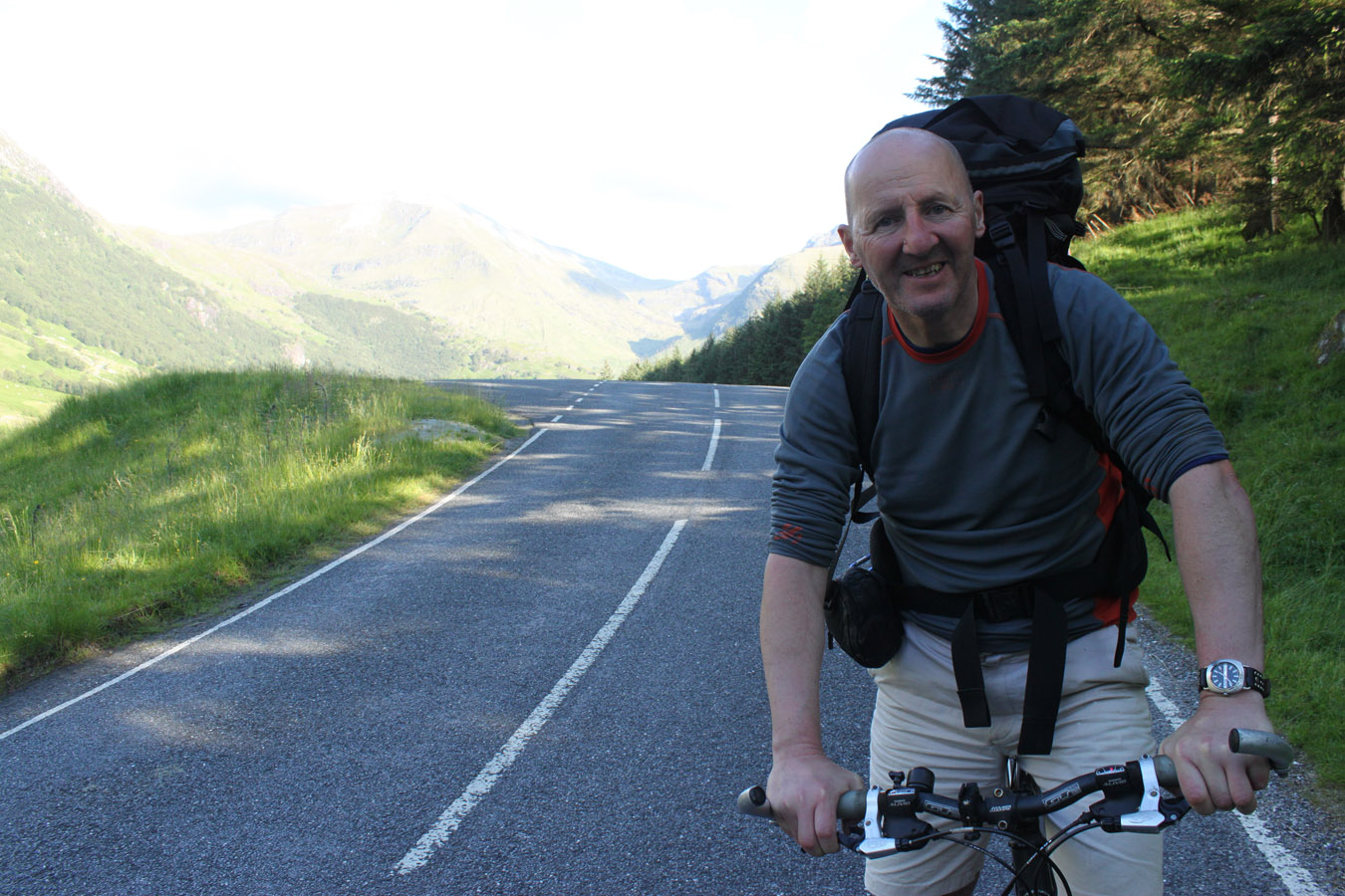
He dropped us back at the bikes at Achriabhach. We cycled down Glen Nevis - absolutely exhausted and sore, to the Youth Hostel, picked our things up and got on our way home. With about 15 minutes until departure, Dougie cycled off to a chip shop and arrived at the station with a couple minutes to departure! If the guy hadn't given us that lift, I doubt we would have made it.
After stinking out the train, we got a change of clothes and a spray. We sat with burgers, chips and Irn-Bru, watching the sun go down on Rannoch Moor. I caught myself even dreaming being up on the hills! I'd only spent four days among them, but the Buachaille and Blackmount was awfully appealing. The rest of the train journey was spent in sort of tired discomfort - physically I was sore all over, and looking forward to my bed. I got off at Westerton and bed followed soon after. Dougie took the train straight through to Edinburgh.
Thanks Dougie for a top quality trip.


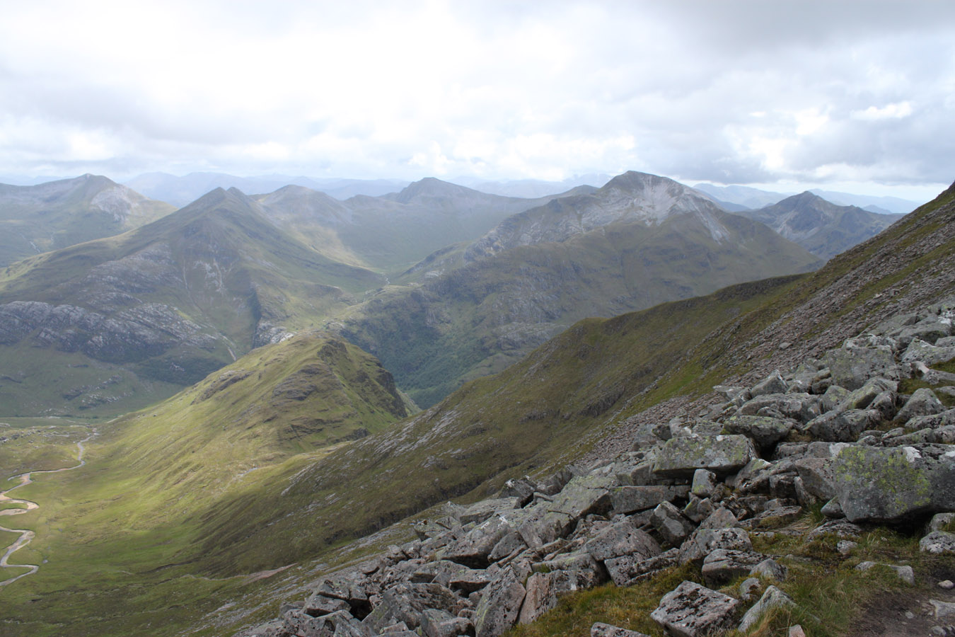
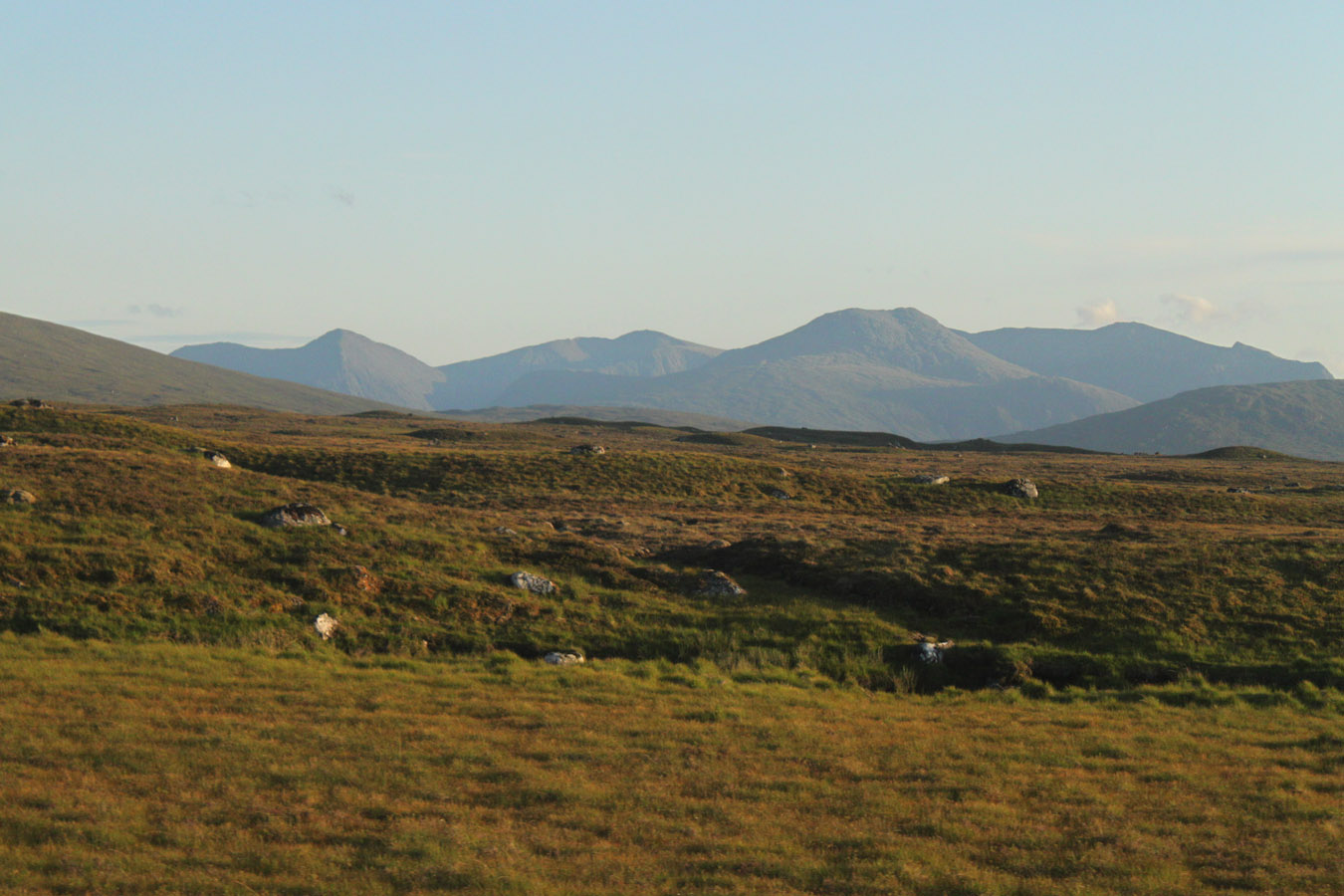
Panorama
Southern Highlands from Ben Nevis, c. 1150m
Times (Time relative to 0.00)
(0.00) 7.00am Left 730m campsite below Aonach Beag
(2.25) c. 8.15am Stob Coire Bhealaich
(4.00) 9.00am Aonach Beag
(4.35) 10.00am Aonach Mor
(5.50) 10.25am Aonach Mor (left)
(6.20) 12.55pm Carn Mor Dearg
(6.40) 1.05pm Carn Dearg Meadhonach
(6.40) 1.25pm Carn Mor Dearg (2nd time)
(6.40) 1.35pm Carn Mor Dearg (left)
(7.55) 3.20pm Ben Nevis
(8.40) 3.40pm Ben Nevis (left)
(8.40) 6.05pm Glen Nevis road-head
(8.40) c. 6.50pm Achriabhach
(9.10) 7.10pm Glen Nevis Youth Hostel
Written: 2011-08-04